Norfolk County Map Antique Europe Atlas Maps
All
Auction
Buy it now
20 results
Antique 1897 South East & Central England large map. 125 yrs old. London, Oxford
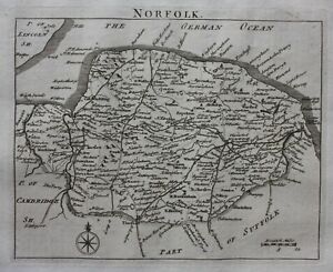
BusinessEUR 19.02EUR 11.86 postageNORFOLK, original antique map from 'Britannia Depicta', E. Bowen, 1759
BusinessEUR 46.16EUR 12.53 postage1896 North Norfolk & Lincolnshire coast map. Victorian England. Cromer, Fakenham
BusinessEUR 16.66EUR 5.93 postage1895 Norfolk county map. Victorian print. Kings Lynn, Great Yarmouth.
BusinessEUR 17.30EUR 5.28 postageNORFOLK, Darton Hand Coloured Original Miniature Antique County Map 1822
BusinessEUR 50.12EUR 9.89 postage1896 North Suffolk & South Norfolk map. Victorian England. Norwich, Southwold.
BusinessEUR 16.30EUR 5.26 postage1804 (1858) Antique Map: Norfolk by Cole from The Railway & Pedestrian Atlas
BusinessEUR 19.77EUR 5.61 postageNORFOLK original antique county map, LEWIS, CREIGHTON, WALKER, 1848
BusinessEUR 27.70EUR 12.53 postage1831 Lewis Map Norfolk County England Norwich Cromer Wells King's Lynn Yarmouth
BusinessEUR 25.30Was: EUR 31.62EUR 21.08 postage1814 John Cary Road Map Norfolk Norwich Yarmouth Walsham Downham Holt England UK
BusinessEUR 29.51Was: EUR 36.89EUR 21.08 postage