Missouri Antique North America County Maps
415 results
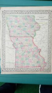
1873 Mitchell's Atlas Map Iowa and Missouri, Authentic Hand-Colored 12 x 16"
PrivateEUR 105.06EUR 38.91 postagePettis County Missouri Houstonia Lamonte Green Ridge c. 1900 Rand McNally map
BusinessEUR 89.83Was: EUR 99.81EUR 30.66 postageIowa & Missouri County Map Des Moines St. Louis 1882 Mitchell map
BusinessEUR 61.46Was: EUR 68.29EUR 32.38 postage1870 Samuel Augustus Mitchell Antique State Map of Iowa and Missouri
BusinessEUR 93.46EUR 12.60 postageOld Antique 1899 Plat Map ~ CYRENE Twp., PIKE Co., MISSOURI ~ LOUISIANA
PrivateEUR 31.470 bidsEUR 36.35 postageEnding Today at 8:32PM BST35m 43s2 Part - Old 1899 Plat Map ~ NORTH & SOUTH LOUISIANA, PIKE Co., MISSOURI
PrivateEUR 31.470 bidsEUR 36.35 postageEnding Today at 9:20PM BST1h 23mOld Antique 1899 Plat Map ~ CYRENE Twp., PIKE Co., MISSOURI ~ EDGEWOOD
PrivateEUR 31.470 bidsEUR 23.51 postageEnding Today at 9:00PM BST1h 3mOld Antique 1899 Plat Map ~ .BOOTH Twp., PIKE Co., MISSOURI ~ BOWLING GREEN
PrivateEUR 31.470 bidsEUR 23.51 postageEnding Today at 11:36PM BST3h 39mOld Antique 1899 Plat / County Map ~ PIKE COUNTY, MISSOURI ~ BOWLING GREEN
PrivateEUR 31.470 bidsEUR 23.51 postageEnding Today at 10:56PM BST2h 59mOld Antique 1899 Plat Map ~ BOWLING GREEN COUNTY SEAT of PIKE Co., MISSOURI
PrivateEUR 31.470 bidsEUR 36.35 postageEnding Today at 11:18PM BST3h 21m1886 Tunison Map Iowa Des Moines Cedar Rapids Council Bluffs Waterloo Fort Dodge
BusinessEUR 37.81Was: EUR 47.27EUR 21.00 postage1864 Map Missouri and Iowa County Map Antique Original Hand Colored Mitchell
PrivateEUR 52.00EUR 28.39 postageAntique 1877 Plat Map SCOTTSVILLE Twp., SULLIVAN Co., MISSOURI ~ PARSON Creek
PrivateEUR 48.27Was: EUR 51.35EUR 23.51 postage1867 Map of St. Louis, Missouri Mitchell Brothers Hand-colored engraved Antique
PrivateEUR 52.52EUR 37.36 postageLot of 6 Carthage Missouri Brochures & Jasper County Map
PrivateEUR 16.80Was: EUR 21.00EUR 28.29 postageOld 1899 Plat Map ~ ASHBURN Twp., PIKE Co., MISSOURI ~ ANNANDA - ST CLEMENT
PrivateEUR 31.470 bidsEUR 23.51 postageEnding Thursday at 9:51PM BST2d 1h1872 Campbell Swallow's Geological Rock Sections Map Pilot Knob Missouri Geology
BusinessEUR 63.04Was: EUR 78.79EUR 21.00 postage1918 Plat / County Map ~ MONTGOMERY COUNTY, MISSOURI (15x17)-#001
PrivateEUR 31.470 bidsEUR 23.51 postageEnding Thursday at 8:38PM BST2dMap of Missouri with Railroads, Counties, Towns Color Plate circa 1900
BusinessEUR 13.65EUR 21.11 postage1876 Map - Township 65 North; Range 11 West - Residence -Scotland County, Mo.
PrivateEUR 78.74EUR 41.69 postage1876 - Map of Township 64 North; Range 10 West - Scotland County, Mo.
PrivateEUR 41.97EUR 40.61 postageNew listing1899 Plat Map ~ .WATSON Twp., PIKE Co., MISSOURI ~ CHICAGO & ALTON RAILROAD
PrivateEUR 45.37Was: EUR 48.27EUR 23.51 postageNew listingOld Antique 1899 Plat Map ~ Mc CUNES Sta. Twp., PIKE Co., MISSOURI ~ READING P.O
PrivateEUR 45.37Was: EUR 48.27EUR 23.51 postage1873 - Campbell's Map of Missouri - 4 Counties - Adrain - Monroe - Pike -Ralls
PrivateEUR 57.73EUR 41.07 postage1872 Campbell Engelmann's Climatological Map of Missouri Climate Zones Rainfall
BusinessEUR 63.04Was: EUR 78.79EUR 21.00 postage1888 Color County Map States of Iowa and Missouri see title page picture
PrivateEUR 14.56EUR 26.39 postage1899 Color Map States of Missouri & Iowa Very Clean Detailed Near Mint Map
PrivateEUR 14.56EUR 26.39 postage1873 Missouri County Railroad Map St. Louis Jefferson City Columbia Sedalia MO
BusinessEUR 147.08Was: EUR 161.98EUR 21.00 postage1886 Tunison Map Missouri St. Louis Jefferson City Columbia Springfield Kansas
BusinessEUR 33.61Was: EUR 42.01EUR 21.00 postage1919 Plat Map Nineveh / Liberty Benton Township Adair County Missouri Youngstown
PrivateEUR 18.39EUR 27.40 postage1877 Twp. Plat Map STICKLERVILLE, SULLIVAN Co., MISSOURI ~ GREENCASTLE on Back
PrivateEUR 48.27Was: EUR 51.35EUR 23.51 postage1873 Campbell Missouri Geological Map Ironton Potosi Ozark Iron Mountain Delta
BusinessEUR 105.06Was: EUR 131.32EUR 21.00 postageBrown County, Horton, Kansas, Vintage Map - Schools, Churches, County Roads
PrivateEUR 10.51EUR 25.21 postage1867 County Map of States of Iowa and Missouri Mitchell Brothers Atlas St. Louis
PrivateEUR 39.39Was: EUR 52.52EUR 36.98 postage1873 Campbell Missouri County Map Callaway Cole Montgomery Osage Jefferson City
BusinessEUR 126.07Was: EUR 157.59EUR 21.00 postageMissouri - Map of Ellisville, Missouri - St. Louis County, Mo. - 1909
PrivateEUR 52.48EUR 30.74 postage1873-Campbell's Map of Missouri - 5 Counties - Camden-Dallas-Hickory -Two More
PrivateEUR 57.73EUR 41.07 postage1919 Plat Map Morrow or part of Nineveh Township Adair County Missouri Stahl
PrivateEUR 18.39EUR 27.40 postage1919 Plat Map part of Benton Township Adair County Missouri Kirksville
PrivateEUR 18.39EUR 27.40 postage1919 Plat Map Pettis or Walnut Townships Adair County Missouri Millard Yarrow
PrivateEUR 18.39EUR 27.40 postage1873 Campbell Missouri County Map Crawford Gasconade Franklin Washington Potosi
BusinessEUR 84.05Was: EUR 105.06EUR 21.00 postage1873-Campbell's Map of Missouri - 5 Counties-Greene-Stone-Christian - Two More
PrivateEUR 57.73EUR 41.07 postage1893 -Map-City of Old Orchard & Lockwood Subd., Mo - St. Louis County, Mo.
PrivateEUR 41.97EUR 30.44 postage1898 - Map of Franklin County, Missouri - Fract'l Townships 44-45, N. Range 11 W
PrivateEUR 36.72EUR 40.45 postageDes Peres, Missouri Map - and Township 47, St. Louis County, Mo. - Antique Maps
PrivateEUR 52.48EUR 40.91 postageOld Antique 1877 Plat Map ~ MEDICINE P.O., SULLIVAN Co., MISSOURI ~ MUDDY CREEK
PrivateEUR 48.27Was: EUR 51.35EUR 23.51 postageMissouri - Map of Chesterfield, Missouri - St. Louis County, Mo. - 1909
PrivateEUR 52.48EUR 30.74 postageSmith Township 1914 Plat Map Carroll County Missouri Mandeville Leslie Twp.
PrivateEUR 30.41EUR 26.99 postage1884 Rand McNally Map Missouri St. Louis Jefferson Kansas City - Yellow Version
BusinessEUR 12.61Was: EUR 15.76EUR 21.00 postage1893 - Map - City of Meacham Park, Mo. - St. Louis County, Missouri -Antique Map
PrivateEUR 36.72EUR 30.28 postageOld Antique 1877 Plat Map ~ BOMANEVILLE - LINDLEY Twp., SULLIVAN Co., MISSOURI
PrivateEUR 48.27Was: EUR 51.35EUR 23.51 postage1874 Colton Map Missouri St. Louis Kansas City Jefferson Columbia Springfield MO
BusinessEUR 63.04Was: EUR 78.79EUR 21.00 postage