Irish Maps & Atlases
222 results
Laminated Wall Map Of Ireland A & B Roads Motorways Towns & City - 84cm x 100cm
BusinessEUR 38.62EUR 13.97 postageRough Guide Map Ireland (Rough Guide Maps) by Unknown Sheet map Book The Cheap
8M+ feedback. Millions of books, dvds & more in stock!BusinessEUR 14.35EUR 2.26 postageBartholomew's Quarter Inch Map of Ireland - Antrim & Donegal, Sheet 1 - 1947
BusinessEUR 7.96EUR 6.65 postageBartholomew's Quarter Inch Cloth Map of Ireland - Dublin & Athlone - 1946
BusinessEUR 13.28EUR 6.65 postageOrdnance Survey of Ireland Half Inch Map - Galway Bay, Sheet 14 - 1985
BusinessEUR 6.63EUR 6.65 postageOrdnance Survey of Ireland: 1/2" to 1 mile Map - sheet 24 Bantry Bay - 1965 edn
PrivateEUR 2.38EUR 5.98 postageVintage Maps OS Survey of Ireland Bartholomew Donegal & Galway & Mayo + Road Map
PrivateEUR 23.42EUR 13.44 postageBARTHOLOMEW QUARTER INCH MAP OF IRELAND - Sheet 4 - CORK AND KILLARNEY, 1960
PrivateEUR 3.99EUR 5.98 postageVintage Motorists and Street Maps Ireland
PrivateEUR 7.030 bidsEnding Sunday at 8:32PM BST4d 9hEUR 15.70 postage4 x DK Eyewitness Travel Guides: Various Locations: Scotland, Ireland etc (BK4)
BusinessEUR 11.70(EUR 2.93/Unit)EUR 20.75 postageNew listingCollins Ireland Touring Map 9780008369965 Collins Maps - Free Tracked Delivery
BusinessEUR 10.01EUR 4.75 postageTrust Houses Forte Map and Tariff Guide to Hotels In Britain & Ireland 1977
PrivateEUR 9.95EUR 12.98 postageOrdnance Survey of Ireland: 1:50,000 Discovery Map - sheet 78 Co Kerry; 2000 edn
PrivateEUR 2.38EUR 7.04 postageBARTHOLOMEW QUARTER INCH MAP OF IRELAND - Sheet 3 - WEXFORD & TIPPERARY, 1959
PrivateEUR 5.32EUR 5.98 postageOrdnance Survey of Ireland: 1:50,000 1st series Map - sheet 78 Kenmare; 1988 edn
PrivateEUR 1.85EUR 7.04 postageBartholomew's Quarter Inch Vintage Map of Ireland Wexford and Tipperary 1962
PrivateEUR 9.90EUR 13.96 postageOrdnance Survey of Ireland: 1:50,000 Discovery Map 62 Carlow & Wexford; 2003
PrivateEUR 2.65EUR 7.04 postageNational Geographic - A Traveler's Map of Britain & Ireland. (June, 2000).
PrivateEUR 5.86EUR 5.15 postageOrdnance Survey Ireland original antique Bantry & Cape Clear map 1913 Sheet 24
PrivateEUR 22.58EUR 7.97 postageBritish Isles, Ireland, National Geographic, Lot of 2 Educational Maps / Posters
PrivateEUR 3.260 bidsEUR 27.99 postageEnding May 6 at 2:30AM BST4d 14hIreland West Ordnance Survey Holiday Map 1: 250 000, Vintage 1981 Foldout
BusinessEUR 10.53EUR 13.00 postageGreat Britain Ireland Vintage Kummerly And Frey Map London Manchester 1960s Old
BusinessEUR 17.27EUR 6.98 postageEurope Vintage Kummerly And Frey Map 1960s Old France Germany Italy Yugoslavia
BusinessEUR 26.57EUR 6.98 postageAntique Ireland Ordnance Survey Sheet 14, 1/2 Inch To A Mile, 1913, Paper
PrivateEUR 5.84EUR 13.96 postageN. Ireland: Ordnance Survey map 14 Lough Neagh scale 1:50,000, 2012 edition
PrivateEUR 4.51EUR 7.04 postageDublin & Athlone - Vintage Bartholomew’s AA 4 miles To 1 Inch Cloth Backed Map
PrivateEUR 6.970 bidsEnding Thursday at 8:02PM BST1d 8hEUR 14.88 postageLonely Planet Europe's Best Trips: 40 Amazing Road Trips. Various Contributors.
PrivateEUR 17.51EUR 13.24 postageA Complete Set Of 1942 War Office Topographical Maps Of Ireland
PrivateEUR 2,927.64EUR 151.79 postageRoute Planning Atlas of Great Britain and Ireland by R A C Publishing
BusinessEUR 4.67EUR 14.51 postageNew listingVintage IRELAND Touring Map 1966 Barholomew Cloth Edition
PrivateEUR 7.030 bidsEnding May 7 at 12:53PM BST6d 1hEUR 16.06 postage1965 Large ESSO Road Map of Ireland Vintage Historic Old Irish Map 90cm x 42cm
PrivateEUR 15.02EUR 25.19 postageBartholomew's, LIFE-BOAT MAP of Gt Britain & Ireland (Poster) Paper Map, 1970s
PrivateEUR 7.96EUR 7.31 postageIreland: Ordnance Survey map 85 Bantry Bay, County Cork - 1:50,000, 2005
PrivateEUR 4.37EUR 7.04 postageIreland: Bartholomews 1/4"map sheet 2 Dublin & Roscommon; 1:250,000, 1948 cloth
PrivateEUR 3.44EUR 7.04 postageGlovebox Atlas: Ireland - Automobile Association - Maps & Info - 52 Pages - 1990
PrivateEUR 17.20EUR 8.93 postageTourist Information Office - Map of Ireland: 10 miles to 1" + town plans - 1975
PrivateEUR 2.25EUR 5.98 postagePhoenix Park Dublin Ireland Visitors Guide
PrivateEUR 1.160 bidsEnding Friday at 10:02PM BST2d 10hEUR 14.15 postageBartholomew Historic Houses (Poster) Map Britain & Ireland, from The Early 1970s
PrivateEUR 5.30EUR 7.31 postageUK A B Roads Motorway London Ireland Wall Map Laminated Large Wall Map 120X83cm
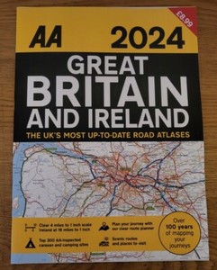
BusinessEUR 29.26EUR 14.35 postage46 soldAA 2024 Great Britain & Ireland A3 Road Atlas Route Planner Map Large Scale UK
PrivateEUR 10.52EUR 12.31 postageVintage Bartholomew's Quarter Inch Maps of Ireland x4 with Cloth Backing
BusinessEUR 17.55EUR 15.72 postageOrdnance Survey Ireland MacGillycuddy's Reeks & Killarney National Park (Map)
Another great item from Rarewaves USA | Free delivery!BusinessEUR 31.67EUR 4.24 postage