1600-1699 Date Range Antique Nautical Maps
All
Auction
Buy it now
53 results
Antique Print-BRITTANY-SEA CHART-QUIMPER-HODIERNE-GROA-Jaillot-Mortier-1693
BusinessEUR 521.37Free postageAntique Celestial Wall Map 1670s by Frederick de Wit Print on Canvas 37inx25in G
PrivateEUR 64.08EUR 21.46 postageRare Antique Map-CHANNEL-LA MANCHE-ENGLAND-FRANCE-SEA CHART-Janssonius-1650
BusinessEUR 1,220.40Free postage= JAN JANSSON (1588-1664) - c. 1640 Tinted Map of WEST AFRICA GUINEA
PrivateEUR 271.73EUR 88.20 postage1693 Jaillot Thames East Coast London Kent Essex Norfolk Antique Map Sea Chart
BusinessEUR 348.35EUR 17.48 postageVintage Marine chart sheet map of Sea coast of Plymouth and Portland
BusinessEUR 11.64EUR 12.21 postage15 watchingVintage sheet map of The Channel Islands Jersey Guernsey Farne circa.1662
BusinessEUR 11.64EUR 12.21 postageVintage Africae nova descriptio 1672 By WILLEM JANSZOON BLAEU (Print Poster)
PrivateEUR 41.81EUR 45.60 postageAntique Print-SEA CHART-ORKNEY ISLANDS-SHAPINSAY-GAIRSAY-WYRE-Collins-1693
BusinessEUR 381.56Free postageAntique Print-GALWAY BAY-LIMERICK-IRELAND-SEACHART-Jaillot-Mortier-1693
BusinessEUR 812.63Free postageAntique Map-WESTERN EUROPE-ATLANTIC-SEA CHART-Dicquemare-Rochette-Faden-1794
BusinessEUR 401.36Free postage1681 Coast Of Barbary Map, A New System of Mathmatics, Jonas Moore, North Africa
PrivateEUR 458.71EUR 33.37 postageVintage Marine chart sheet map of English Chanel French coast English coast
BusinessEUR 11.64EUR 12.21 postageAntique Print-SEA CHART-BARENTS SEA-NORWAY-SVALBARD-NOVA ZEMBLA-Seller-Moll-1671
BusinessEUR 1,220.40Free postageVintage Europa recens descripta 1660 by Guilielmo Blaeuw (Print Poster)
PrivateEUR 36.84EUR 23.05 postageVintage Marine chart sheet map of Sea coast Lands End to Plymouth Cornwall
BusinessEUR 11.64EUR 12.21 postage15 watching1693 Greenvile Collins Sea Chart Fowey Penzance Cornwall Mounts Bay Antique Map
BusinessEUR 227.19EUR 16.31 postageVintage Marine chart sheet map of Sea coast of England Isle of Wight to Dover
BusinessEUR 11.64EUR 12.21 postage6 watchingVintage Marine chart - Admiralty Chart 1975 Thames Estuary Northern Part
PrivateEUR 11.65EUR 16.11 postageVintage Marine chart sheet map The Sea coasts between Dover & Orfordness 1600's
BusinessEUR 11.64EUR 12.21 postage1951 Hydrographic Nautical Chart Port Royal to Pedro Bluff Jamaica 30 x 50" 1683
PrivateEUR 47.05EUR 50.65 postageVintage Marine chart sheet map of Burlington Bay Scarborough Hartlepoole c.1680
BusinessEUR 11.64EUR 12.21 postageBRAZIL 1680 FREDERIK DE WIT UNUSUAL LARGE ANTIQUE ENGRAVED MAP 17TH CENTURY
BusinessEUR 598.72EUR 27.63 postagePas-caart van de Oost zee verthoonende alle de ghelegntheydet tusschen t Eÿlandt
BusinessEUR 898.08EUR 68.71 postage1693 (1750) Antique Map; Collins Chart of Durham /Northumberland Coast Very Good
BusinessEUR 291.25EUR 15.26 postageCarte de la Manche, anno 1692, Sanson-Jaillot, old colours, ORIGINAL MAP
BusinessEUR 524.28Free postage1681 Isle Of Madagascar Map, A New System of Mathmatics, Jonas Moore, Africa
PrivateEUR 506.61EUR 34.93 postageOriginal handcolored engraving by Jan van Vianen, navy , galley 1694., Amsterdam
PrivateEUR 1,565.88EUR 18.42 postageDECORATIVE BOOK PLATE PRINT REPRODUCTION MAP MALUKU SPICE ISLANDS INDONESIA 1630
PrivateEUR 6.61EUR 5.95 postage1774-99 GREENVIL COLLINS 1686 MAP OF HARWICH COAST & SANDBANKS FOR SAMUELL PEPYS
PrivateEUR 378.65EUR 26.95 postageNaval battle Gibraltar, 25.04.1607, Gottfried anno 1642, copperengraving
BusinessEUR 506.61EUR 32.96 postageCarte Particuliere Des Costes De Normandie....Mortier Pierre, anno 1693-ORIGINAL
BusinessEUR 1,657.99EUR 78.71 postageCARTE MARITIME des Environs de DIEPPE depuis PONT ASSELANE jusques au HAVRE
BusinessEUR 1,565.88EUR 67.39 postage1647 Dudley Nautical Chart or Maritime Map of the Mouth of the Amazon River
BusinessEUR 2,279.74EUR 41.45 postageEuropa recens descripta 1660 by Guilielmo Blaeuw (Print Poster) 21" X 16"
PrivateEUR 26.04EUR 47.48 postageAcores insulae-Acores, Ortelius A., anno 1603, ORIGINAL-CONTEMPORARY COLOURS
BusinessEUR 921.11EUR 46.43 postageWEST INDIES - CARIBBEAN - WINDWARD ISLANDS BY J. OTTENS, CIRCA 1745.
BusinessEUR 1,306.82EUR 15.68 postageWEST INDIES - CARIBBEAN - INSULAE AMERICANAE IN OCEANO SEPT. BY JANSSONIUS, 1636
BusinessEUR 1,306.82EUR 15.68 postage


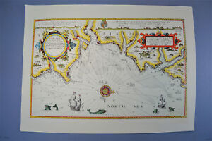
![Pascaart vant Canaal, Tusschen Engelant en Vrancryck [...]](https://i.ebayimg.com/thumbs/images/g/zC8AAOSwKXVlb1DC/s-l300.jpg)