Missouri Antique North America Sheet Maps
55 results
Missouri Geological Survey And Water Resources Index Map Jan 1970 Box 250 Rolla
PrivateEUR 35.90Was: EUR 42.23EUR 24.43 postageVTG CIVIL WAR MAP! REBEL FORTIFICATIONS ON THE MISSISSIPPI RIVER AT NEW MADRID!
PrivateEUR 169.30EUR 22.16 postageAntique Map 1920s | Map Of The Ozark Playgrounds | Steele Undertaking | 17 X 21”
PrivateEUR 200.94EUR 37.92 postageMissouri - Berrymam Quadrangle (1943 survey) Original...
PrivateEUR 35.90Was: EUR 42.23EUR 44.63 postage1897 Map East part of United States Original antique print
PrivateEUR 1.850 bidsEUR 6.51 postageEnding Sunday at 8:19PM BST3d 4h1897 Map Western part of United States Original antique print USA
PrivateEUR 1.850 bidsEUR 6.51 postageEnding Sunday at 8:30PM BST3d 5h1897 Map of United States & Mexico Original antique print
PrivateEUR 1.850 bidsEUR 6.51 postageEnding Sunday at 8:14PM BST3d 4hMISSOURI Ruth Taylor VINTAGE ORIGINAL Cartoon Map 1935 6 Color Litho EX COND
BusinessEUR 15.83EUR 28.30 postage1884 ANTIQUE MAP Indian Removal CHEROKEE NATION 32" Arkansas Kansas Missouri
PrivateEUR 137.25EUR 24.86 postageMap of Missouri with Railroads, Counties, Towns Color Plate circa 1900
BusinessEUR 13.72EUR 21.21 postageAntique Map: United States of America Missouri Compromise Act, 1899
PrivateEUR 5.230 bidsEnding May 14 at 7:13PM BST5d 3hEUR 11.97 postage1852 Historic Map - Location of Indian Tribes within the United States
Compiled and Drawn by Captain S. EastmanPrivateEUR 186.06EUR 31.96 postage1909 Antique Color Map Cedar County Missouri Filley Stockton Balm 29 X 25 #0388
BusinessEUR 42.13EUR 26.42 postageOriginal Vintage Map of the Missouri Pacific Railway St. Louis, Iron Mt. - 1910
BusinessEUR 21.12EUR 27.93 postageOriginal Vintage Map of the Missouri Pacific Railroad Company 1917
BusinessEUR 21.12EUR 27.93 postage1882 Antique Map: Coast Survey, Atlantic-Pacific con., Illinois & Missouri 23
BusinessEUR 12.67EUR 25.93 postageMap War Secession West Operations 1871 Victorian Woodcut Print History DWAA12
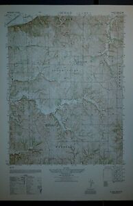
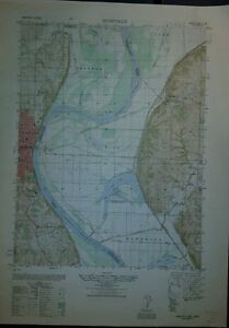
PrivateEUR 14.25Was: EUR 31.67EUR 25.60 postage1940's Army map Tracy Missouri Sheet 7062 IV NE w/ Aerial Photo on Reverse
BusinessEUR 36.94EUR 26.65 postage1903 Antique Map Missouri Shelby County Shelbyville Bethel Hunnewell 28X27 #9965
BusinessEUR 26.29EUR 25.94 postage1940's Army map De Kalb Missouri Sheet 7063 III SW w/ Aerial Photo on Reverse
BusinessEUR 36.94EUR 26.65 postage1940's Army map Edgerton Missouri Sheet 7063 II SW w/ Aerial Photo on Reverse
BusinessEUR 36.94EUR 26.65 postage1940's Army map Dearborn Missouri Sheet 7063 III SE w/ Aerial Photo on Reverse
BusinessEUR 36.94EUR 26.65 postage1879 Map West Central States Group Victorian Atlas Geography 1st Edition DWAA9
PrivateEUR 38.01Was: EUR 84.46EUR 30.78 postage1940's Army map Gower Missouri Sheet 7063 II SE w/ Aerial Photo on Reverse
BusinessEUR 36.94EUR 26.65 postage1903 Antique Map Shelby County Missouri Shelbyville Bethel Lakenan 28X27 #4280
BusinessEUR 31.57EUR 26.10 postage1940's Army map Rushville Missouri Sheet 6963 II SE w/ Aerial Photo
BusinessEUR 42.22EUR 26.81 postage1914 Antique Map Missouri Grundy County Spickard Trenton Edinburg 27 X 25" #8868
BusinessEUR 42.13EUR 26.42 postage1913 Antique Map Missiouri Nodaway Maryville Clearmont Elmo Hopkins 37X34 #4702
BusinessEUR 31.57EUR 28.67 postage1940's Army map Ferrelview Kansas City Missouri Sheet 7062 I SW w/ Aerial Photo
BusinessEUR 42.22EUR 26.81 postage1914 Antique Map Missouri Dekalb County Maysville Fairport Amity 27 X 23" #8869
BusinessEUR 42.13EUR 26.42 postage1914 Antique Map Missouri Harrison County Bethany Blythedale 30 X 34" #8867
BusinessEUR 42.13EUR 26.42 postage1906 Antique Map Putnam County Missouri Unionville Lucerne Livonia 41X19 #4332
BusinessEUR 31.57EUR 26.10 postageoriginal 1906 USGS map of Bolivar, Buffalo, Urbana, Hermitage, Wheatland, MO
PrivateEUR 68.63EUR 22.84 postage1906 Antique Map Putnam County Missouri Unionville Howland Livonia 41 X 1 #8564
BusinessEUR 42.13EUR 26.42 postageoriginal 1905 USGS map of Butler, Rich Hill, Appleton, Creighton,MO Island Mound
PrivateEUR 89.75EUR 39.30 postageoriginal 1905 USGS map of Greenfield, MO & Mt. Vernon, Ash Grove Walnut Grove
PrivateEUR 58.07EUR 38.36 postageoriginal 1894 USGS map of Independence, Blue Springs Excelsior Liberty MO
PrivateEUR 105.59EUR 23.93 postageoriginal 1900 USGS map of Versailles, Aurora Springs, Linn Creek, MO
PrivateEUR 47.51EUR 38.05 postageoriginal 1901 USGS map of Carthage, Sarcoxie, Golden City, Lamar, Webb City, MO
PrivateEUR 79.19EUR 38.98 postageImproving Upper Missouri River, Dikes Built at Mandan North Dakota, 1896
PrivateEUR 27.91EUR 28.46 postage1877 Coast & Geodetic Survey Triangulation Map #22 Missouri & Illinois
PrivateEUR 47.51EUR 28.98 postageImproving Missouri River in Front of Sioux City, Iowa, with Pile Dikes - 1895
PrivateEUR 28.61EUR 34.84 postage1877 Coast & Geodetic Survey Triangulation Map #22 Missouri & Illinois
PrivateEUR 47.51EUR 28.98 postage