Picture 1 of 12


Gallery
Picture 1 of 12


Have one to sell?
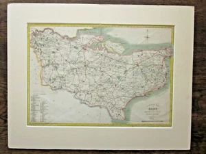
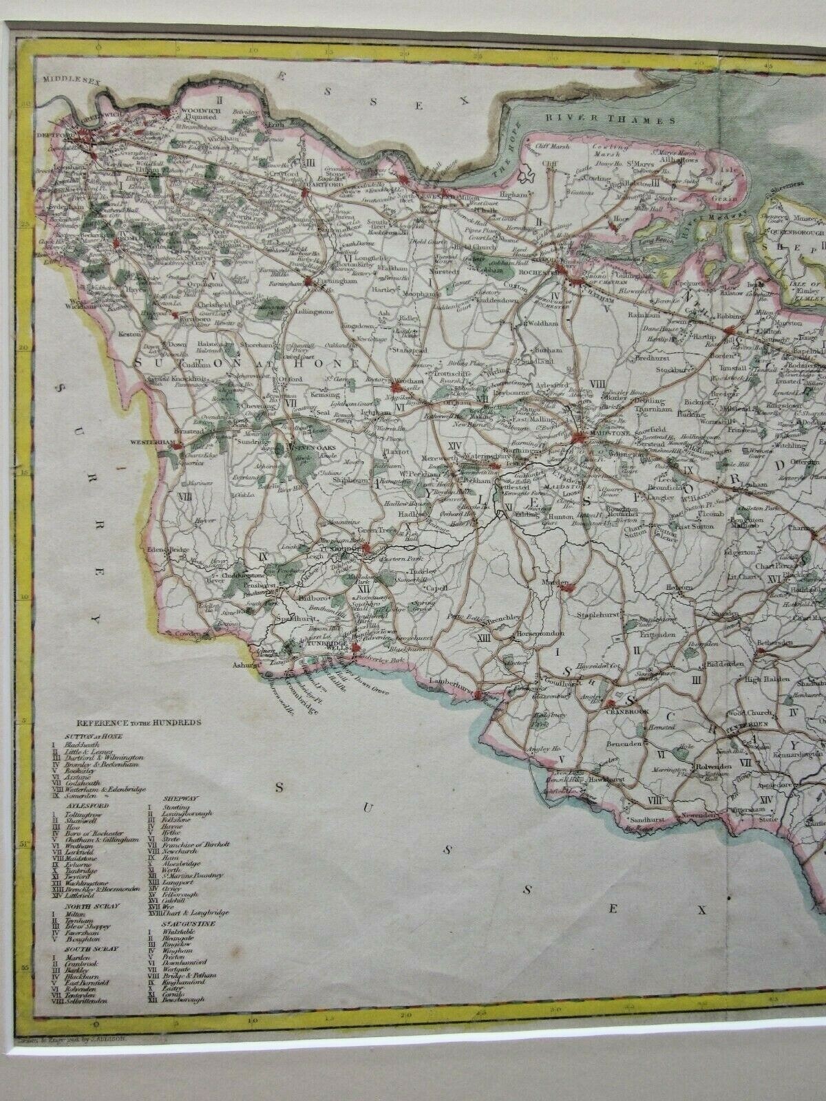
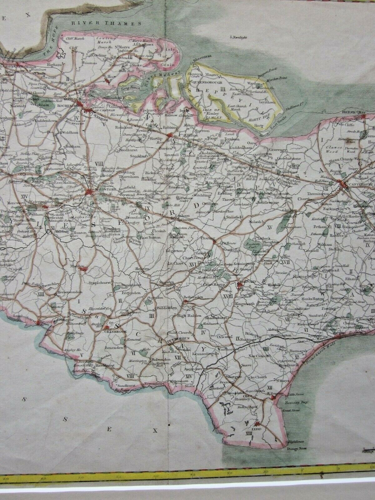
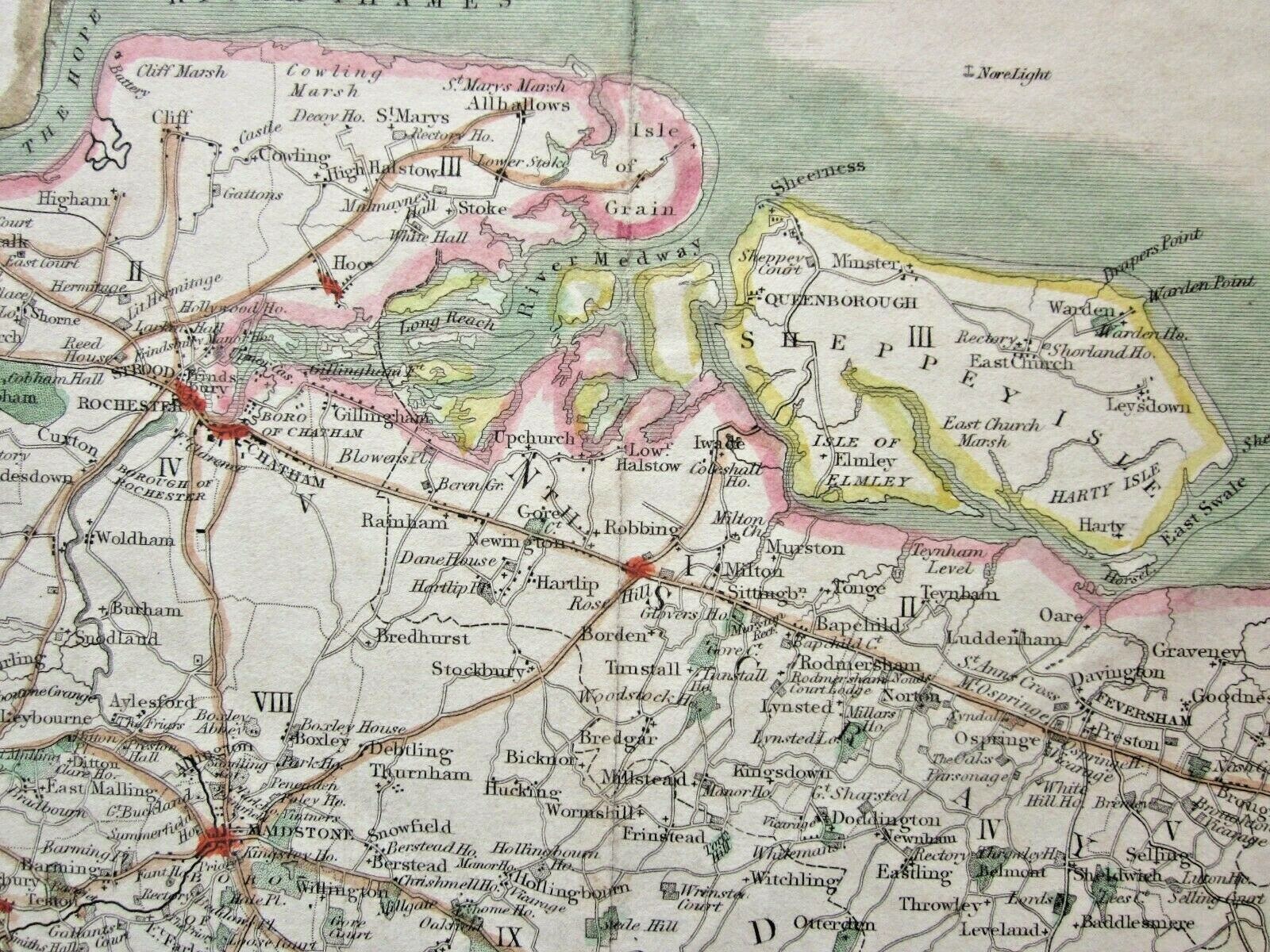
1839 Greenwood Select Map Kent Epitome History London Canterbury Antique SCARCE

£85.00
ApproximatelyEUR 98.43
or Best Offer
Condition:
“Small foxing marks in the lower area, and a diagonal crease at the bottom. Centrefold as issued. ”... Read moreAbout condition
- Buy it now1839 Greenwood Select Map Kent Epitome History London Canterbury Antique SCARCE
Oops! Looks like we're having trouble connecting to our server.
Refresh your browser window to try again.
Postage:
£18.00 (approx EUR 20.84) International Tracked Postage.
Located in: Fairlight, United Kingdom
Delivery:
Estimated between Wed, 27 Aug and Fri, 12 Sep
Returns:
30 days return. Buyer pays for return postage. If you use an eBay delivery label, it will be deducted from your refund amount.
Payments:
Shop with confidence
Seller assumes all responsibility for this listing.
eBay item number:126073239098
Item specifics
- Seller notes
- County
- Kent
- Cartographer/Publisher
- C Greenwood, drawn by J Addison.
- Original/Reproduction
- Antique Original
- Format
- Sheet Map
- Type
- County Map
- Year
- 1839
- Date Range
- 1800-1899
- City
- London, Canterbury, Maidstone
- Country/Region
- England
- Era
- Victorian
- Antique/ Modern
- Antique
Item description from the seller
Seller business information
About this seller

Maps Music and More with Mitchmap50
100% positive Feedback•5.1K items sold
Registered as a business seller
Seller Feedback (2,763)
- eBay 自動留下信用評價- Feedback left by buyer.Past month訂單成功完成 — 物品享追蹤服務且準時送達
- eBay 自動留下信用評價- Feedback left by buyer.Past month訂單成功完成 — 物品享追蹤服務且準時送達
- eBay 自動留下信用評價- Feedback left by buyer.Past month訂單成功完成 — 物品享追蹤服務且準時送達
More to explore:
- Antique European Maps & Atlases London Kent,
- London Kent Antique Europe Sheet Maps,
- London Kent Antique Europe Ordnance Survey Maps,
- Kent Antique Europe County Maps,
- Kent Antique Europe Sheet Maps,
- Antique European Maps & Atlases Kent,
- Kent Antique Original Antique European Maps & Atlases,
- London London Antique Europe City Maps,
- Kent Contemporary Antique Europe Sheet Maps,
- London London Antique Europe Folding Maps
Maps Music and More with Mitchmap50
100% positive Feedback•5.1K items sold
Registered as a business seller
Seller Feedback (2,763)
- eBay 自動留下信用評價- Feedback left by buyer.Past month訂單成功完成 — 物品享追蹤服務且準時送達
- eBay 自動留下信用評價- Feedback left by buyer.Past month訂單成功完成 — 物品享追蹤服務且準時送達
- eBay 自動留下信用評價- Feedback left by buyer.Past month訂單成功完成 — 物品享追蹤服務且準時送達