Picture 1 of 12


Picture 1 of 12


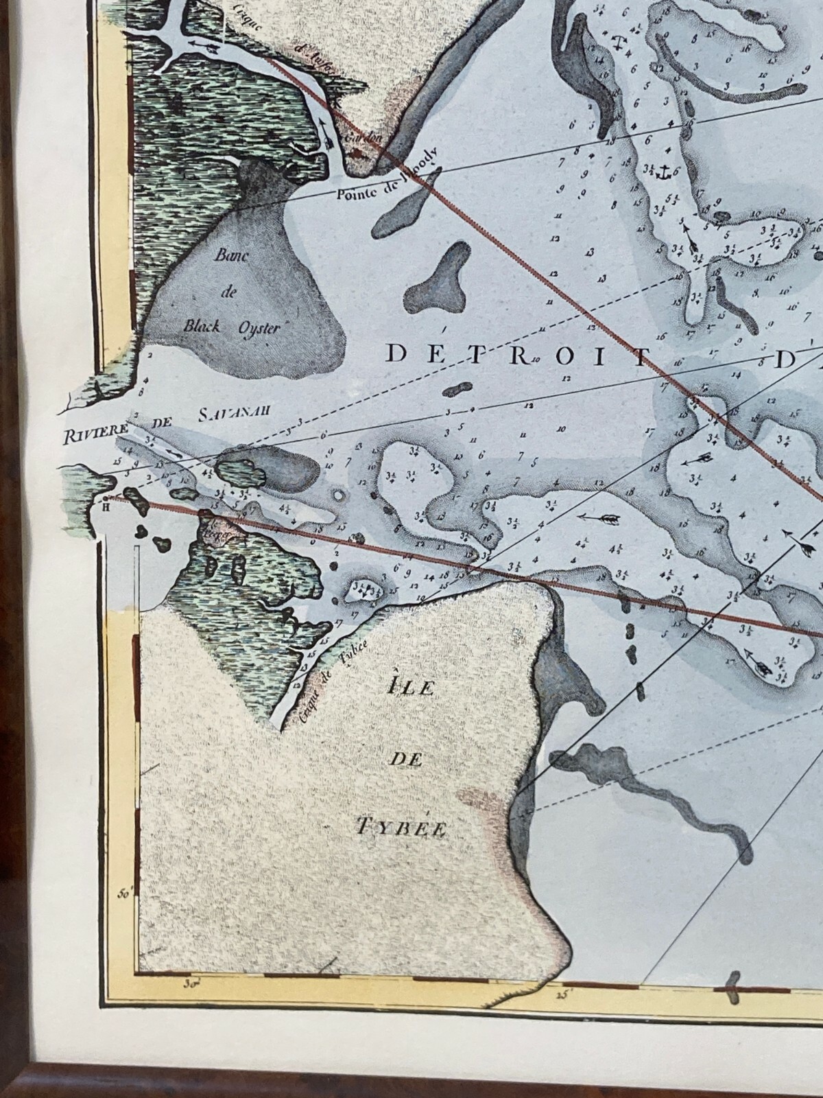


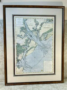
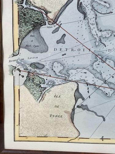
Plan de Port Royal Map 1778 Reproduction Print Troy Livres Framed & Matted

US $714.40
ApproximatelyEUR 641.12
or Best Offer
Was US $893.00 (20% off)
Condition:
“1778 Plan de Port Royal done by Troy Livres captures the Hilton Head Island and Port Royal ara of ”... Read moreAbout condition
Ended: 24 Jul, 2024 13:03:40 BST
Collection:
Free collection in person from Georgetown, Delaware, United States.
Postage:
US $68.63 (approx EUR 61.59) UPS Ground.
Located in: Georgetown, Delaware, United States
Delivery:
Estimated between Wed, 25 Sep and Fri, 27 Sep to 43230
Returns:
30 days return. Seller pays for return postage.
Payments:
Shop with confidence
Seller assumes all responsibility for this listing.
eBay item number:126495850235
Item specifics
- Seller notes
- Date Range
- 1930-1939
- Type
- Colony Map
- Year
- 1778
- South Carolina Map from 1700s period
- Hilton Head Island and Port Royal areas in Map
- 1778 Reproduction Map
- Plan de Port Royal Et De La Riviere et Du Detroit
- Cartographer/Publisher
- Troy Livres
- Original/Reproduction
- Reproduction
Item description from the seller
Business seller information
Timeless Tokens
David Hall
25236 Prettyman Rd
19947 Georgetown, DE
United States
I certify that all my selling activities will comply with all EU laws and regulations.

More to explore:
- Reproduction Antique County Maps,
- Reproduction Antique Wall Maps,
- Reproduction Antique Sheet Maps,
- Reproduction Antique Physical Maps,
- Reproduction Antique Maps, Atlases & Globes,
- Vintage Reproduction Antique County Maps,
- Antique Reproduction Antique Maps, Atlases & Globes,
- Antique Reproduction Antique World Maps & Atlases,
- John Speed Antique Reproduction Antique County Maps,
- Antique Reproduction World Antique World Maps & Atlases