Picture 1 of 5


Picture 1 of 5

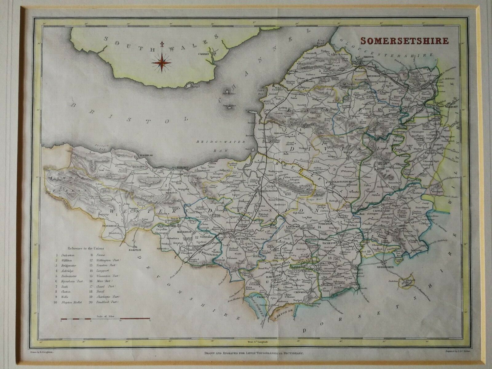


ANTIQUE HAND COLOUR MAP OF SOMERSET FROM LEWIS TOPOGRAPHICAL DICTIONARY-CA 1840

£35.00
ApproximatelyEUR 41.71
or Best Offer
Condition:
Postage:
£25.00 (approx EUR 29.80) Royal Mail International Tracked.
Located in: Bournemouth, United Kingdom
Delivery:
Estimated between Sat, 28 Sep and Thu, 3 Oct to 43230
Returns:
No returns accepted.
Payments:
Shop with confidence
Seller assumes all responsibility for this listing.
eBay item number:133961091225
Item specifics
- Date Range
- 1800-1899
- Antique
- Yes
- Type
- County Map
- Format
- Atlas Map
- Printing Technique
- Lithography
- Year
- 1840 CIRCA
- State
- SOMERSETSHIRE
- Cartographer/Publisher
- R.CREIGHTON/J.& C. WALKER
- Original/Reproduction
- Antique Original
- Country/Region
- England
- County
- SOMERSETSHIRE
Item description from the seller
Registered as a private seller
Thereby, consumer rights stemming from EU consumer protection law do not apply. eBay buyer protection still applies to most purchases.
Seller Feedback (205)
- e***n (3205)- Feedback left by buyer.Past monthVerified purchaseSmooth transaction, as described really nice biblical print. Thanks
- o***p (23)- Feedback left by buyer.Past monthVerified purchaseVery responsive seller
- s***k (61)- Feedback left by buyer.Past monthVerified purchaseExcellent quality well wrapped and delivered promptly
More to explore:
- Somerset Antique Europe Topographical Maps,
- Somerset Antique Europe Folding Maps,
- Antique Topographical Maps,
- Somerset Antique Europe Sheet Maps,
- Somerset Antique Europe Atlas Maps,
- Somerset Antique Original Antique Europe Atlas Maps,
- Antique Europe Topographical Maps,
- Antique Africa Topographical Maps,
- Antique Asia Topographical Maps,
- Topographical Map Antique Africa Atlas Maps