Picture 1 of 9


Picture 1 of 9
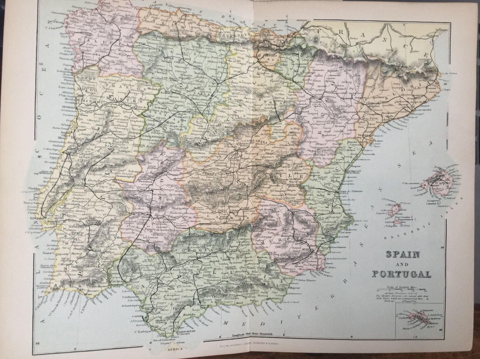


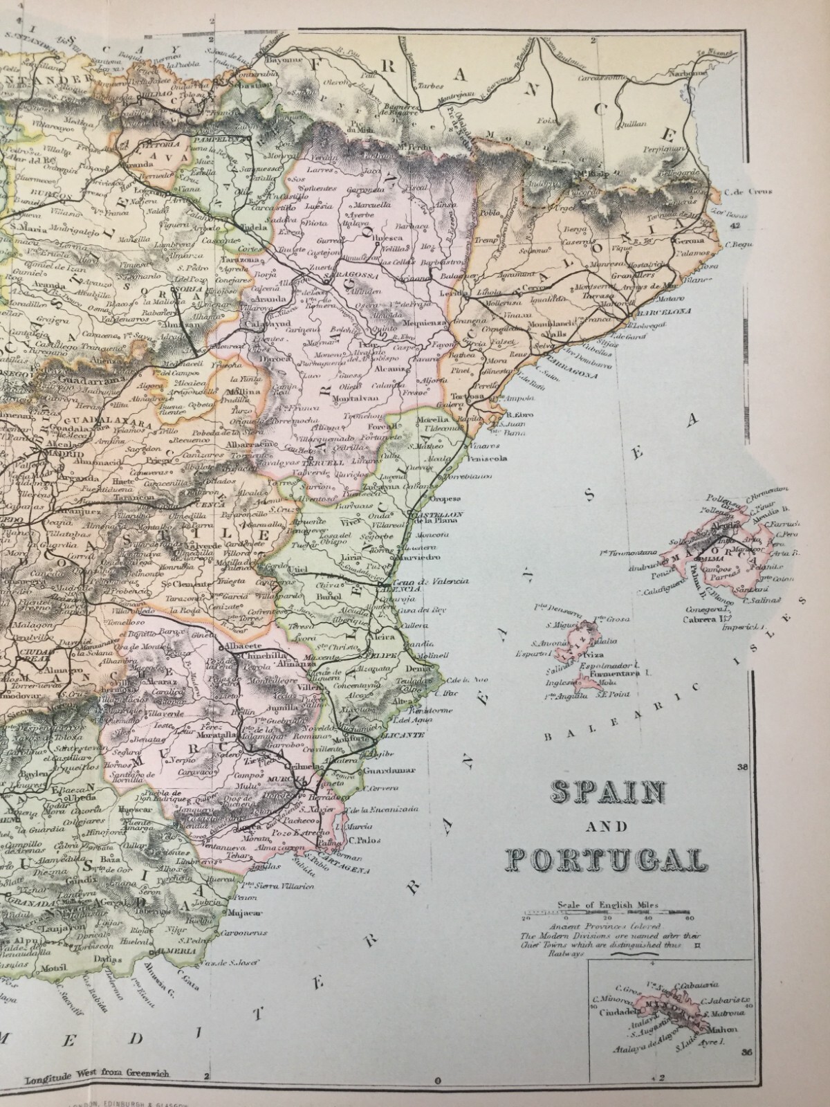


Antique Map Of Spain & Portugal Map Of Europe Dated C1870's Map Of The World

£13.99
ApproximatelyEUR 16.78
Condition:
Postage:
£4.95 (approx EUR 5.94) Standard Int'l Postage.
Located in: Great Torrington, Devon, United Kingdom
Delivery:
Estimated between Fri, 27 Sep and Wed, 9 Oct to 43230
Returns:
No returns accepted.
Payments:
Shop with confidence
Seller assumes all responsibility for this listing.
eBay item number:135074880740
Item specifics
- Antique
- Yes
- Printing Technique
- Lithography
- Cartographer/Publisher
- William Mackenzie
- City
- Barcelona
- County
- n/a
- Date Range
- 1800-1899
- Type
- World Atlas
- Format
- Atlas
- Year
- 1870
- Era
- 1800s
- State
- N/A
- Original/Reproduction
- Antique Original
- Country/Region
- Europe, Portugal, Spain
Item description from the seller
Business seller information
Ocean Arts North Devon
Mark Brown
75 Castle Hill Gardens
Torrington
Devon
EX38 8EX
United Kingdom
I certify that all my selling activities will comply with all EU laws and regulations.

Registered as a business seller
More to explore:
- World Political Map Antique World Atlas Maps,
- World Thematic Map Antique World Atlas Maps,
- Nautical Map Antique World Sheet Maps,
- Geological Map Antique World Sheet Maps,
- City Map Antique World Sheet Maps,
- Geological Map Antique Europe Sheet Maps,
- Antique World Maps & Atlases,
- County Map Antique Europe Atlas Maps,
- Nautical Map Antique Europe Folding Maps,
- Antique World Wall Maps