Picture 1 of 4


Gallery
Picture 1 of 4


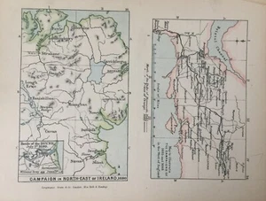
Antique Map Dated Campaign In North East Ireland In 1690 Europe Print 1905
Condition:
Oops! Looks like we're having trouble connecting to our server.
Refresh your browser window to try again.
Postage:
£4.95 (approx EUR 5.82) Standard Int'l Postage.
Located in: Great Torrington, Devon, United Kingdom
Delivery:
Estimated between Thu, 8 May and Mon, 19 May to 43230
Returns:
No returns accepted.
Payments:
Shop with confidence
Seller assumes all responsibility for this listing.
eBay item number:135743830553
Item specifics
- Antique
- Yes
- Printing Technique
- Lithography
- Cartographer/Publisher
- School atlas
- City
- londonderry
- County
- Londonderry
- Date Range
- 1900-1909
- Type
- World Atlas
- Format
- School Map
- Year
- 1905
- Era
- 1900s
- State
- N/A
- Original/Reproduction
- Vintage Original
- Country/Region
- Europe, Ireland
Item description from the seller
Seller business information
About this seller

oceanartsnorthdevon
100% positive Feedback•10K items sold
Registered as a business seller
Seller Feedback (4,072)
- 3***b (2167)- Feedback left by buyer.Past monthVerified purchaseGreat 👍
- eBay automated feedback- Feedback left by buyer.Past monthOrder completed successfully—tracked and on time
- eBay automated feedback- Feedback left by buyer.Past monthOrder completed successfully—tracked and on time
More to explore:
- Campaign Antique Chests,
- 1970-1979 Date Range Antique Europe County Maps,
- North Dakota Antique North American Maps & Atlases 1900-1909 Date Range,
- Antique North American Maps & Atlases 1950-1959 Date Range,
- North Carolina Antique North American Maps & Atlases 1800-1899 Date Range,
- North Dakota Antique North American Maps & Atlases 1920-1929 Date Range,
- Antique North American Maps & Atlases 1920-1929 Date Range,
- 1960-1969 Date Range County Map Antique Europe Sheet Maps,
- 1940-1949 Date Range Nautical Map Antique Europe Sheet Maps,
- 1800-1899 Date Range Topographical Map Antique Europe Folding Maps
Seller Feedback (4,072)
- 3***b (2167)- Feedback left by buyer.Past monthVerified purchaseGreat 👍
- eBay automated feedback- Feedback left by buyer.Past monthOrder completed successfully—tracked and on time
- eBay automated feedback- Feedback left by buyer.Past monthOrder completed successfully—tracked and on time