Picture 1 of 3


Picture 1 of 3

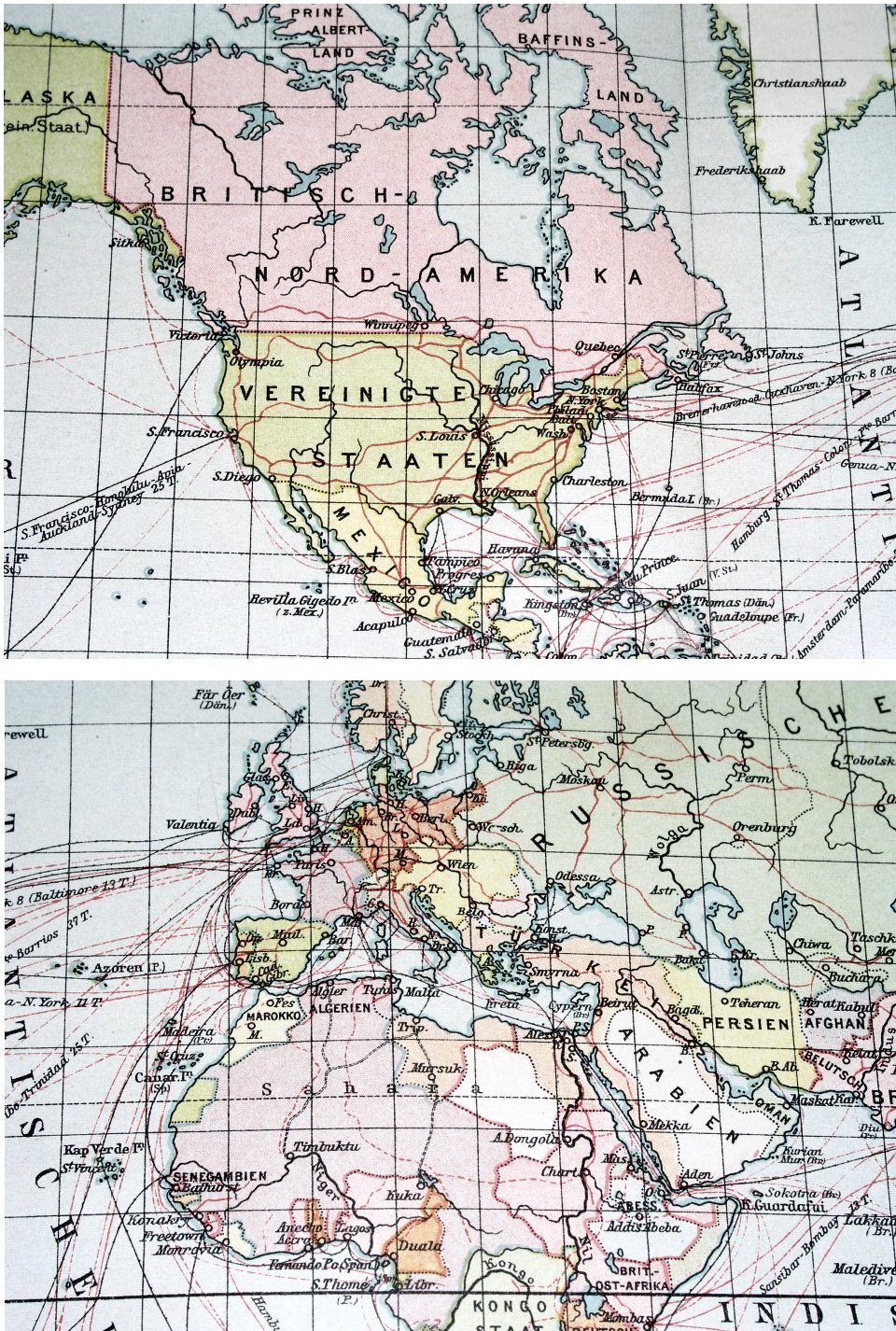

1905 ANTIQUE MAP OF THE WORLD / GERMAN BRITISH FRENCH COLONIES SHIP ROUTES

US $20.19
ApproximatelyEUR 18.11
or Best Offer
Condition:
“STAINS. THE MAP IS REINFORCED ON BACK ALONG THE CENTERFOLD.”
Postage:
US $5.00 (approx EUR 4.48) Standard Shipping from Canada.
Located in: Montreal, Quebec, Canada
Delivery:
Estimated between Mon, 30 Sep and Tue, 1 Oct to 43230
Returns:
30 days return. Seller pays for return postage.
Payments:
Shop with confidence
Seller assumes all responsibility for this listing.
eBay item number:156225055507
Item specifics
- Seller notes
- “STAINS. THE MAP IS REINFORCED ON BACK ALONG THE CENTERFOLD.”
- Date Range
- 1900-1909
Item description from the seller
Business seller information
ANDRZEJ LESZCZEWICZ
Andrzej Leszczewicz
, QC
Canada
I certify that all my selling activities will comply with all EU laws and regulations.

More to explore:
- Antique World Maps & Atlases,
- British Colonial Antique Furniture,
- World Antique World Maps & Atlases,
- Antique World Wall Maps,
- World Antique World Wall Maps,
- British Colonial Antique Doors,
- Antique Reproduction World Antique World Maps & Atlases,
- Antique World Nautical Maps,
- Antique World Railroad Maps,
- Antique World County Maps