Picture 1 of 14


Gallery
Picture 1 of 14


Have one to sell?
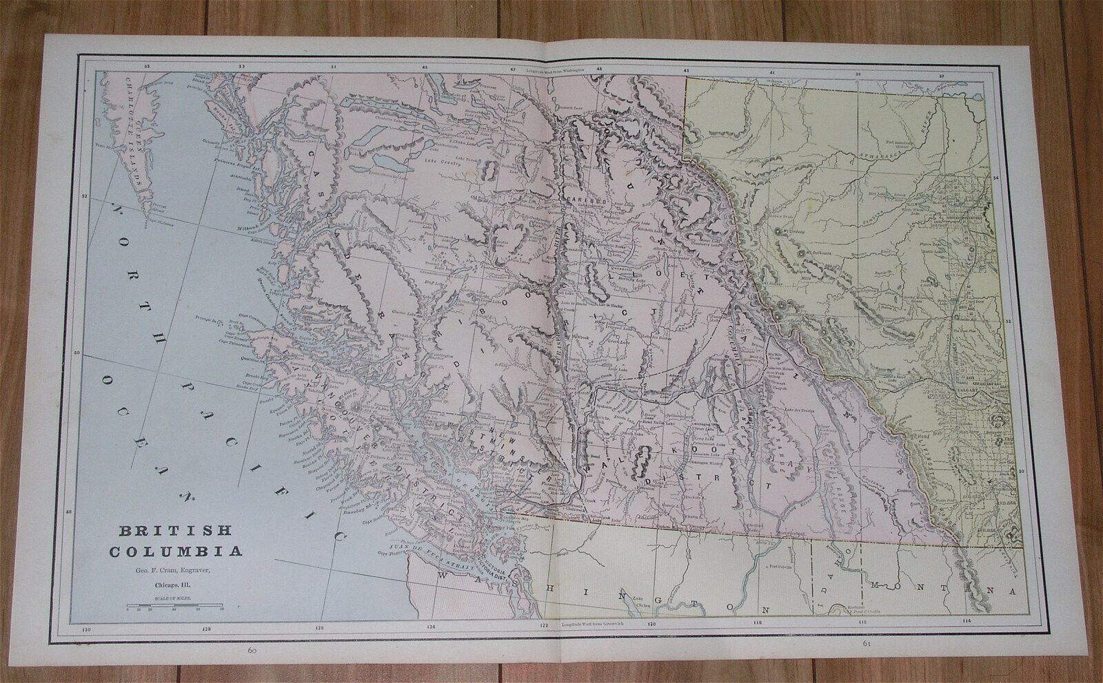
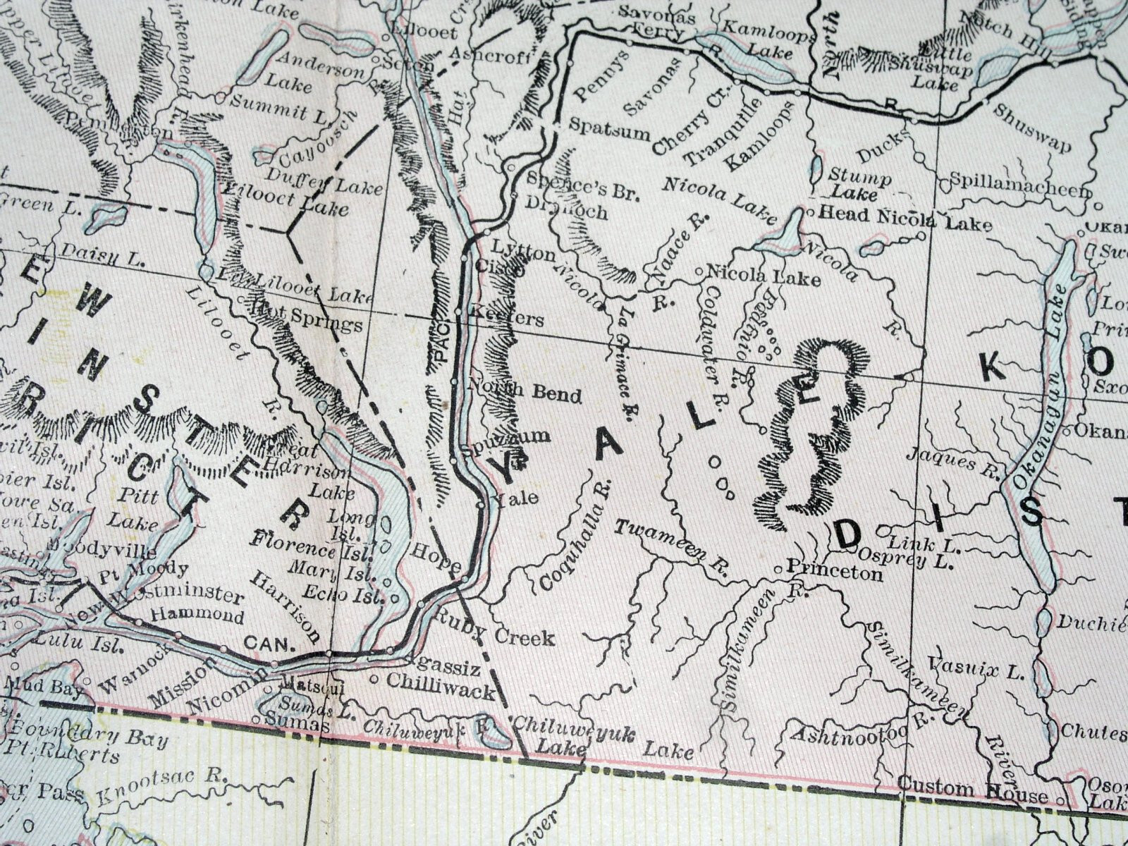
1890 ANTIQUE MAP OF BRITISH COLUMBIA VANCOUVER ISLAND ROCKIES ALBERTA CALGARY

US $33.87
ApproximatelyEUR 29.67
or Best Offer
Condition:
“SEVERAL STAINS AND PRINTING ERRORS - PLEASE SEE THE PHOTOS.”
- Buy it now1890 ANTIQUE MAP OF BRITISH COLUMBIA VANCOUVER ISLAND ROCKIES ALBERTA CALGARY
Oops! Looks like we're having trouble connecting to our server.
Refresh your browser window to try again.
Postage:
Free Standard Shipping from Canada.
Located in: Montreal, Quebec, Canada
Delivery:
Estimated between Wed, 6 Aug and Mon, 11 Aug to 94104
Returns:
60 days return. Seller pays for return postage.
Payments:
Shop with confidence
Seller assumes all responsibility for this listing.
eBay item number:157194925918
Item specifics
- Seller notes
- “SEVERAL STAINS AND PRINTING ERRORS - PLEASE SEE THE PHOTOS.”
- Date Range
- 1800-1899
- Year
- 1890
- Canadian Province
- Alberta, British Columbia
- City
- Vancouver
Item description from the seller
Seller business information
About this seller

Andrews Old Maps and Prints
100% positive Feedback•20K items sold
Registered as a business seller
Seller Feedback (10,871)
- 1***v (400)- Feedback left by buyer.Past monthVerified purchaseGreat!!
- 1***v (400)- Feedback left by buyer.Past monthVerified purchaseExcellent!!
- c***j (5754)- Feedback left by buyer.Past monthVerified purchaseA fast and flawless transaction!
More to explore:
- Antique North American Maps & Atlases Vancouver,
- Antique North American Maps & Atlases British Columbia,
- British Columbia Antique North America Atlas Maps,
- British Columbia Antique Original Antique North America Maps & Atlases,
- Antique North American Maps & Atlases Alberta,
- Antique Pre 1890 Decade,
- Antique Doors Pre 1890 Decade,
- Copper 1890s Decade Architectural Antiques,
- Black Antique Pre 1890 Decade,
- Brass Antique Pre 1890 Decade
Seller Feedback (10,871)
- 1***v (400)- Feedback left by buyer.Past monthVerified purchaseGreat!!
- 1***v (400)- Feedback left by buyer.Past monthVerified purchaseExcellent!!
- c***j (5754)- Feedback left by buyer.Past monthVerified purchaseA fast and flawless transaction!