Picture 1 of 6


Gallery
Picture 1 of 6
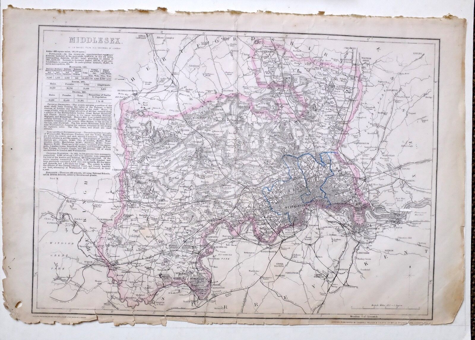
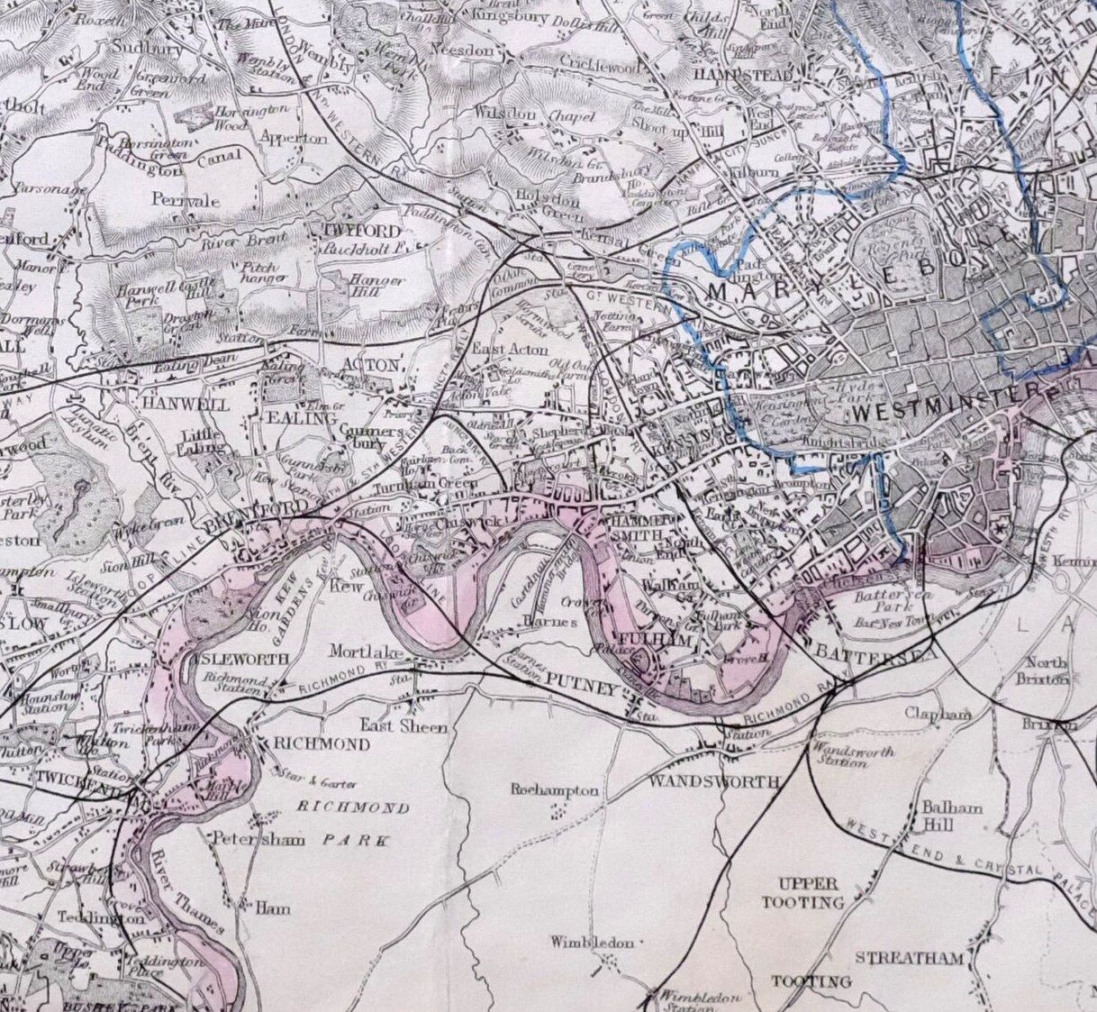
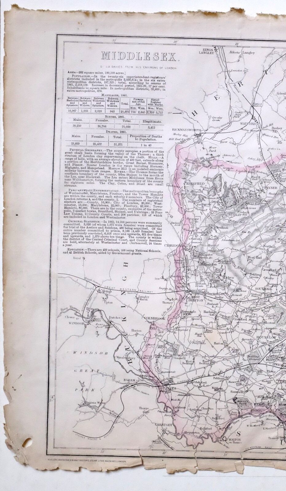
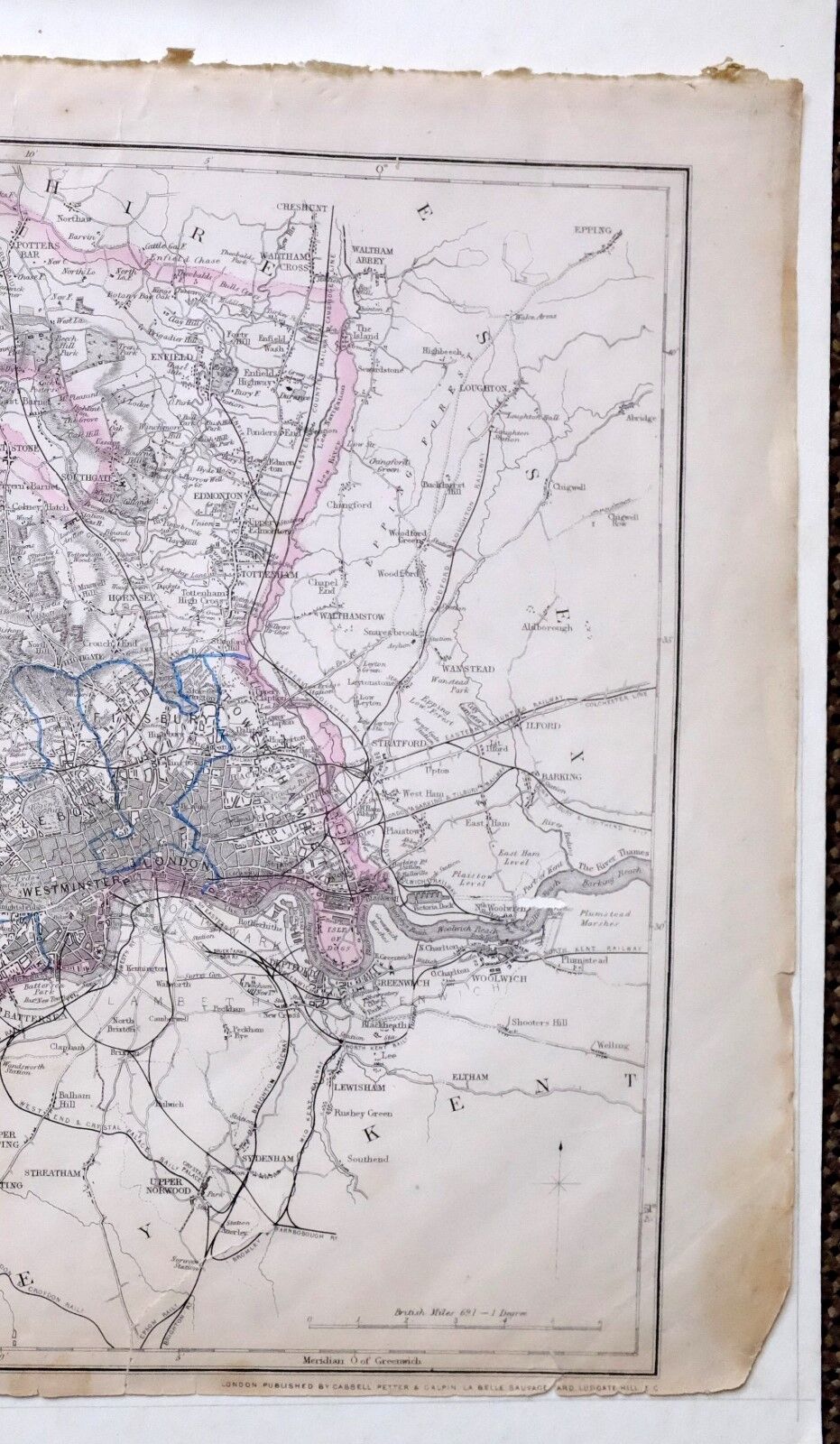
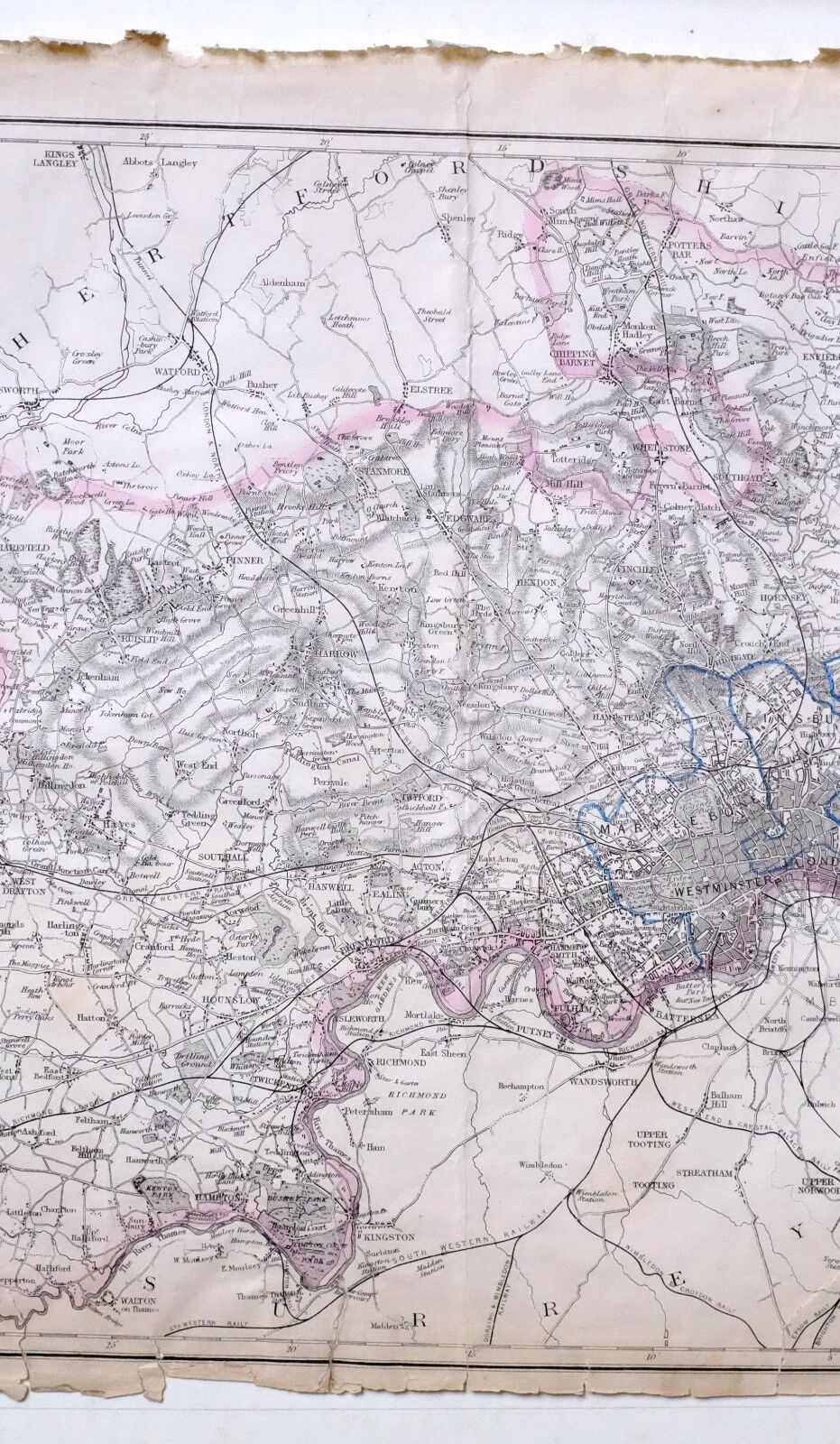
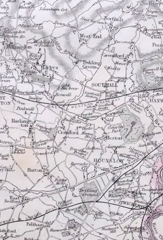

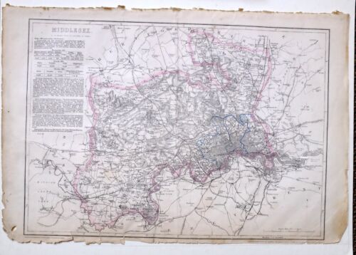
1864 LARGE ANTIQUE MAP ~ MIDDLESEX LONDON WESTMINSTER WEST DRAYTON HAREFIELD
£88.00
ApproximatelyEUR 104.69
or Best Offer
Condition:
“THERE MAY BE SIGNS OF HANDLING/AGE MARKS/ANNOTATIONS THERE MAY BE EVIDENCE OF REPAIRS WITH ARCHIVAL ”... Read moreAbout condition
- Buy it now1864 LARGE ANTIQUE MAP ~ MIDDLESEX LONDON WESTMINSTER WEST DRAYTON HAREFIELD
Oops! Looks like we're having trouble connecting to our server.
Refresh your browser window to try again.
Postage:
£15.00 (approx EUR 17.84) Royal Mail International Tracked.
Located in: York, United Kingdom
Delivery:
Estimated between Mon, 19 May and Tue, 27 May to 43230
Returns:
14 days return. Buyer pays for return postage. If you use an eBay delivery label, it will be deducted from your refund amount.
Payments:
Shop with confidence
Seller assumes all responsibility for this listing.
eBay item number:162568737584
Item specifics
- Seller notes
- Type
- From scarce cassells atlas
- Year
- 1864
- Date Range
- 1800-1899
Item description from the seller
Seller business information
About this seller

YORK fine prints
99.8% positive Feedback•40K items sold
Registered as a business seller
Seller Feedback (20,095)
- e***s (888)- Feedback left by buyer.Past monthVerified purchase★ ★ FAST SHIPPING ! PERFECT ! THANK YOU SO MUCH ★ ★
- c***i (1023)- Feedback left by buyer.Past monthVerified purchaseExcellent transaction. Thank you!
- d***d (3940)- Feedback left by buyer.Past monthVerified purchaseExcellent.
More to explore:
- London Middlesex Antique Europe Sheet Maps,
- Antique European Maps & Atlases London Middlesex,
- London Middlesex Antique Europe County Maps,
- London Middlesex Antique Europe Ordnance Survey Maps,
- Middlesex Antique Europe Topographical Maps,
- Middlesex County Map Antique Europe Sheet Maps,
- London Antique European Maps & Atlases Middlesex 1800-1899 Date Range,
- Middlesex County Map Antique Europe Atlas Maps,
- Middlesex Antique Europe Ordnance Survey Maps,
- London London Antique Europe County Maps
Seller Feedback (20,095)
- e***s (888)- Feedback left by buyer.Past monthVerified purchase★ ★ FAST SHIPPING ! PERFECT ! THANK YOU SO MUCH ★ ★
- c***i (1023)- Feedback left by buyer.Past monthVerified purchaseExcellent transaction. Thank you!
- d***d (3940)- Feedback left by buyer.Past monthVerified purchaseExcellent.