Picture 1 of 2

Picture 1 of 2


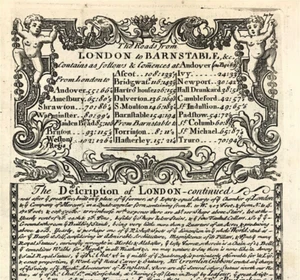
map London to Barnstable Description Owen & Bowen maps antique 1720

£26.80
ApproximatelyEUR 32.17
Condition:
“Good Condition - Please see description below”
Postage:
£7.90 (approx EUR 9.48) Standard Int'l Postage.
Located in: Bourne End, United Kingdom
Delivery:
Estimated between Mon, 30 Sep and Thu, 10 Oct to 43230
Returns:
30 days return. Buyer pays for return postage.
Payments:
Shop with confidence
Seller assumes all responsibility for this listing.
eBay item number:166784031715
Item specifics
- Seller notes
- “Good Condition - Please see description below”
- Printing Technique
- Copper Plate
- Cartographer/Publisher
- John Owen / Emanuel Bowen
- City
- Barnstable
- County
- London
- Maker
- John Owen / Emanuel Bowen
- Date Range
- 1700-1799
- Continent
- Europe
- Type
- Road Map
- Format
- Sheet Map
- Year
- c1720
- Era
- 1700s
- Original/Reproduction
- Antique Original
- Country/Region
- England
- Antique/ Modern
- Antique
Item description from the seller
Business seller information
Rare Maps and Prints Ltd
Kevin Ryan
4 Ray House
Cressington Place
Bourne End
Buckinghamshire
SL8 5SL
United Kingdom
CRN Number:
- 11235906
Trade registration number:
- 11235906
I certify that all my selling activities will comply with all EU laws and regulations.

More to explore:
- Emanuel Bowen London Antique Europe County Maps,
- Emanuel Bowen London Antique Europe Maps & Atlases,
- Emanuel Bowen Antique County Maps,
- Emanuel Bowen County Map Antique Sheet Maps,
- Emanuel Bowen Antique Sheet Maps,
- London Antique Europe Folding Maps,
- Antique European Maps & Atlases London,
- London London Antique Europe Sheet Maps,
- London Antique Europe City Maps,
- London London Antique Europe City Maps