Picture 1 of 16


Gallery
Picture 1 of 16


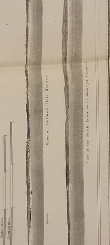
1859 US Coast Survey chart map Muskeget Channel Massachusetts
US $85.00
ApproximatelyEUR 75.24
or Best Offer
Condition:
- Buy it now1859 US Coast Survey chart map Muskeget Channel Massachusetts
Oops! Looks like we're having trouble connecting to our server.
Refresh your browser window to try again.
Postage:
Free USPS Ground Advantage®.
Located in: Lafayette, Colorado, United States
Delivery:
Estimated between Thu, 8 May and Wed, 14 May to 43230
Returns:
No returns accepted.
Payments:
Shop with confidence
Seller assumes all responsibility for this listing.
eBay item number:197262309254
Item specifics
- Date Range
- 1850-1899
- Type
- Nautical chart or map
- US State
- Massachusetts
- Format
- Folding Map
- Printing Technique
- Lithography
- Year
- 1859
- Original/Reproduction
- Antique Original
- Cartographer/Publisher
- A. D. Bache
- City
- Muskeget Channel
- Country/Region
- United States of America
Item description from the seller
About this seller
dprussi7
100% positive Feedback•142 items sold
Registered as a private sellerThereby, consumer rights stemming from EU consumer protection law do not apply. eBay buyer protection still applies to most purchases.
Seller Feedback (62)
- r***1 (1365)- Feedback left by buyer.Past monthVerified purchaseItems arrived promptly and as described.
- u***b (3)- Feedback left by buyer.Past monthVerified purchaseEverything great
- e***t (156)- Feedback left by buyer.Past 6 monthsVerified purchaseExcellent communication with seller. The magazine was much nicer than expected and packaged nicely. Thank you.
More to explore:
- Antique Ordnance Survey Maps,
- Antique North American Maps & Atlases Massachusetts,
- Antique Europe Ordnance Survey Maps,
- Ordnance Survey Map Antique Folding Maps,
- Ordnance Survey Map Antique Sheet Maps,
- 1930-1939 Antique Ordnance Survey Maps,
- Vintage Original Antique Ordnance Survey Maps,
- 1950-1959 Antique Ordnance Survey Maps,
- 1910-1919 Antique Ordnance Survey Maps,
- 1800-1899 Antique Ordnance Survey Maps