Picture 1 of 10


Gallery
Picture 1 of 10


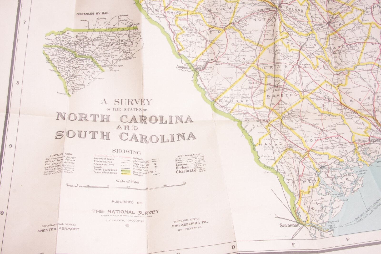


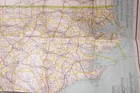
Carolina Map National Survey LV Crocker Linen Backed ~1920 36x47" OBX Rail C027A
US $79.95
ApproximatelyEUR 70.81
Condition:
- Buy it nowCarolina Map National Survey LV Crocker Linen Backed ~1920 36x47" OBX Rail C027A
Oops! Looks like we're having trouble connecting to our server.
Refresh your browser window to try again.
Postage:
Free USPS Priority Mail®.
Located in: Shelburne Falls, Massachusetts, United States
Save on combined postage
Delivery:
Estimated between Tue, 6 May and Fri, 9 May to 43230
Posts today if you order in the next 7 hrs 40 mins
Returns:
30 days return. Seller pays for return postage.
Payments:
Shop with confidence
Seller assumes all responsibility for this listing.
eBay item number:223077731474
Item specifics
- Cartographer/Publisher
- LV Crocker
- Original/Reproduction
- Vintage Original
- Format
- Folding Map
- Type
- County Map
- Year
- c.1920
- US State
- NC, SC
- Date Range
- 1920-1929
- Country/Region
- United States of America
Item description from the seller
Seller business information
About this seller

KeenEye Collections
99.8% positive Feedback•20K items sold
Registered as a business seller
Seller Feedback (7,937)
- r***m (83)- Feedback left by buyer.Past monthVerified purchaseFast shipping great seller will order again
- k***o (304)- Feedback left by buyer.Past monthVerified purchasethank you!
- 9***1 (983)- Feedback left by buyer.Past monthVerified purchasePrint was in nice condition, protected with cardboard backing, received promptly. Fine transaction.
More to explore:
- 1920-1929 Antique Ordnance Survey Maps,
- 1920-1929 Date Range Ordnance Survey Map Antique Sheet Maps,
- 1920-1929 Date Range Ordnance Survey Map Antique Folding Maps,
- 1920-1929 Date Range Ordnance Survey Map Antique Europe Folding Maps,
- 1920-1929 Date Range Ordnance Survey Map Antique Europe Sheet Maps,
- Antique Ordnance Survey Maps,
- Antique Europe Ordnance Survey Maps,
- 1940-1949 Antique Ordnance Survey Maps,
- 1930-1939 Antique Ordnance Survey Maps,
- Vintage Original Antique Ordnance Survey Maps
Seller Feedback (7,937)
- r***m (83)- Feedback left by buyer.Past monthVerified purchaseFast shipping great seller will order again
- k***o (304)- Feedback left by buyer.Past monthVerified purchasethank you!
- 9***1 (983)- Feedback left by buyer.Past monthVerified purchasePrint was in nice condition, protected with cardboard backing, received promptly. Fine transaction.