Picture 1 of 7


Gallery
Picture 1 of 7
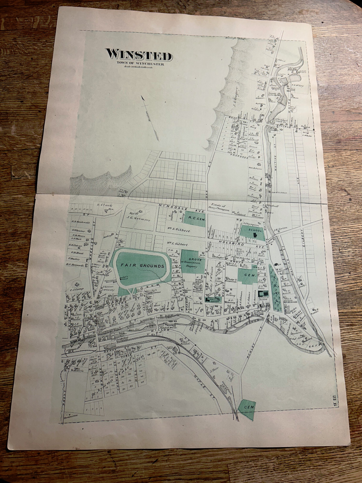


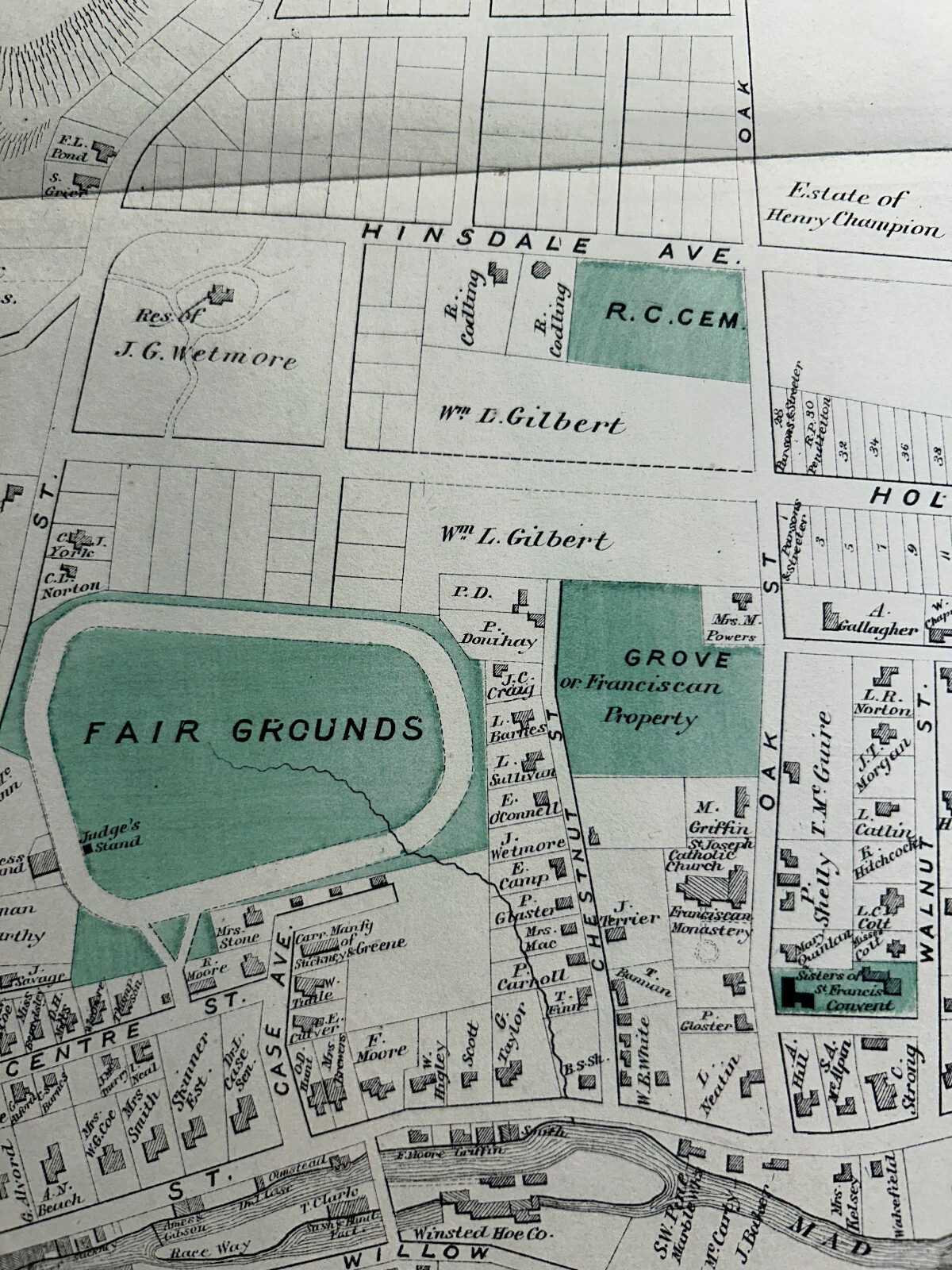


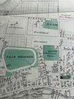
WINSTED - F.W. BEERS 1874 LITCHFIELD COUNTY ATLAS MAPS - BUSINESSES -NAMED HOMES
US $34.99
ApproximatelyEUR 31.16
Condition:
“GOOD”
- Buy it nowWINSTED - F.W. BEERS 1874 LITCHFIELD COUNTY ATLAS MAPS - BUSINESSES -NAMED HOMES
Oops! Looks like we're having trouble connecting to our server.
Refresh your browser window to try again.
Postage:
US $9.75 (approx EUR 8.68) USPS First Class®.
Located in: Ocean Isle Beach, North Carolina, United States
Delivery:
Estimated between Wed, 14 May and Mon, 19 May to 43230
Returns:
No returns accepted.
Payments:
Shop with confidence
Seller assumes all responsibility for this listing.
eBay item number:266950295209
Item specifics
- Seller notes
- “GOOD”
- Date Range
- 1800-1899
- Type
- County Map
- US State
- Connecticut
- Format
- Atlas Map
- Year
- 1874
- SIZE
- APPROX 24 X 16
- Original/Reproduction
- Antique Original
- Cartographer/Publisher
- F.W. BEERS
- City
- LITCHFIELD COUNTY
- Country/Region
- United States of America
Item description from the seller
About this seller

jreeve1
98.7% positive Feedback•5.5K items sold
Registered as a private sellerThereby, consumer rights stemming from EU consumer protection law do not apply. eBay buyer protection still applies to most purchases.
Seller Feedback (4,229)
- r***a (5545)- Feedback left by buyer.Past monthVerified purchaseA+ Seller. Thank you.
- o***l (1385)- Feedback left by buyer.Past monthVerified purchaseThis is a beautiful antique majolica fern plate..highly recommend!
- 1***n (142)- Feedback left by buyer.Past monthVerified purchaseSOME OF THE MOST BEAUTIFUL EARRINGS I OWN! Fast shipping. High quality jewelry!
More to explore:
- County Map Antique Atlas Maps,
- County Map Antique Atlas,
- County Map Antique Europe Atlas Maps,
- County Durham County Map Antique Europe Atlas Maps,
- Lithography County Map Antique Atlas Maps,
- John Bartholomew County Map Antique Atlas Maps,
- Devon County Map Antique Europe Atlas Maps,
- Dorset County Map Antique Europe Atlas Maps,
- Yorkshire County Map Antique Europe Atlas Maps,
- Cornwall County Map Antique Europe Atlas Maps
jreeve1
98.7% positive Feedback•5.5K items sold
Registered as a private sellerThereby, consumer rights stemming from EU consumer protection law do not apply. eBay buyer protection still applies to most purchases.
Seller Feedback (4,229)
- r***a (5545)- Feedback left by buyer.Past monthVerified purchaseA+ Seller. Thank you.
- o***l (1385)- Feedback left by buyer.Past monthVerified purchaseThis is a beautiful antique majolica fern plate..highly recommend!
- 1***n (142)- Feedback left by buyer.Past monthVerified purchaseSOME OF THE MOST BEAUTIFUL EARRINGS I OWN! Fast shipping. High quality jewelry!