Picture 1 of 7


Gallery
Picture 1 of 7


Have one to sell?
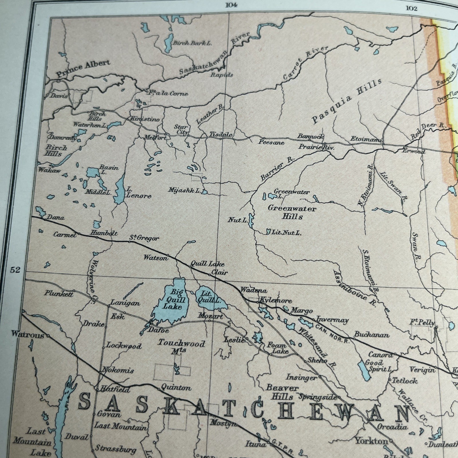
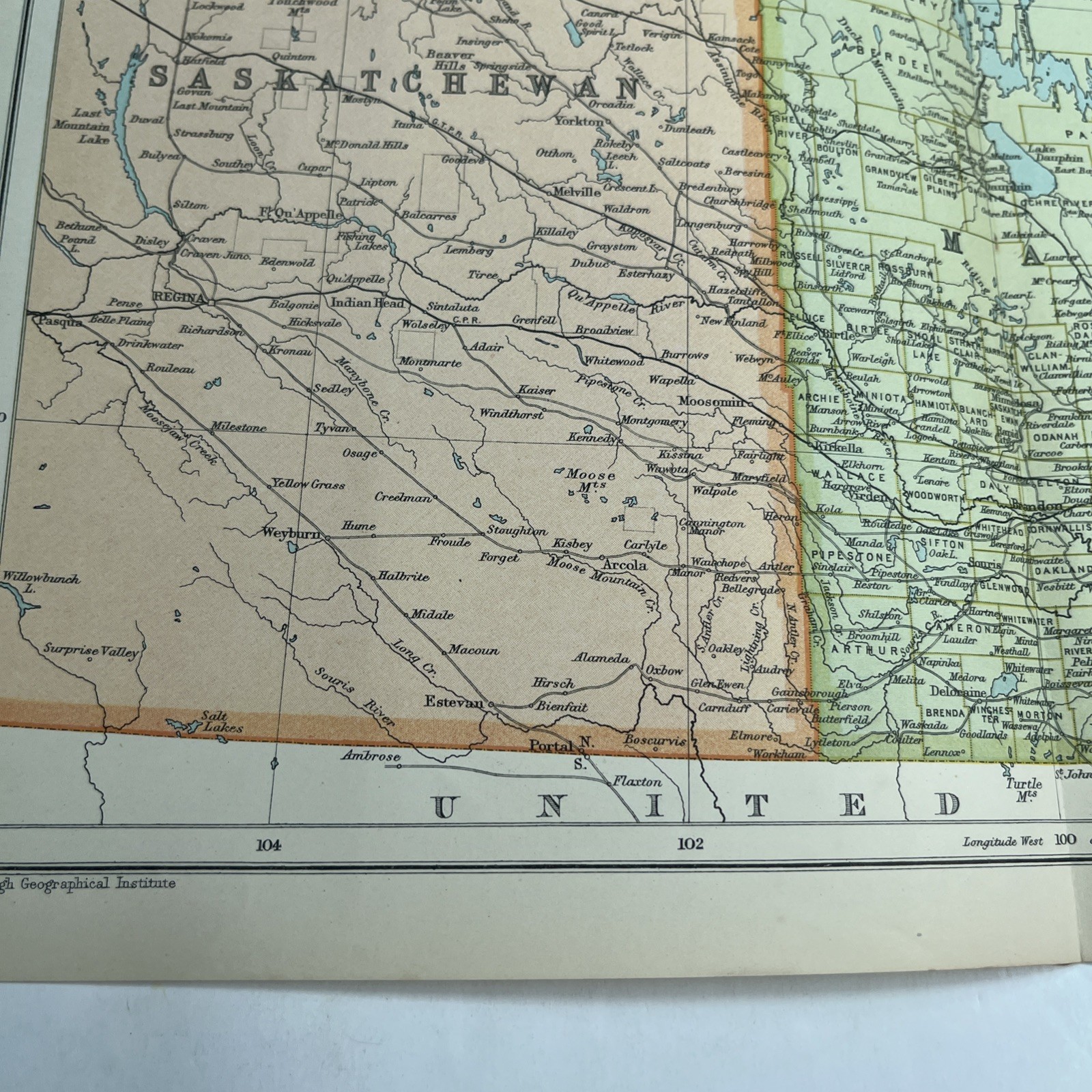
1910: Antique Map Of Manitoba Saskatchewan CS #65 Railway Atlas Antiquarian
£19.95
ApproximatelyEUR 22.85
or Best Offer
Condition:
- Buy it now1910: Antique Map Of Manitoba Saskatchewan CS #65 Railway Atlas Antiquarian
Oops! Looks like we're having trouble connecting to our server.
Refresh your browser window to try again.
Postage:
Located in: Leicester, United Kingdom
Delivery:
Varies
Returns:
No returns accepted.
Payments:
Shop with confidence
Seller assumes all responsibility for this listing.
eBay item number:277202473344
Item specifics
- Date Range
- 1910-1919
- Antique
- Yes
- Type
- Political Map
- Format
- Folding Map
- Printing Technique
- Lithography
- Year
- 1910
- Canadian Province
- Manitoba, Saskatchewan
- Era
- 1910s
- Original/Reproduction
- Antique Original
- Cartographer/Publisher
- John Bartholomew
Item description from the seller
About this seller
hiddentreasure-uk
99.6% positive Feedback•5.5K items sold
Registered as a private sellerThereby, consumer rights stemming from EU consumer protection law do not apply. eBay buyer protection still applies to most purchases.
Seller Feedback (2,070)
- eBay automated Feedback- Feedback left by buyer.Past monthOrder completed successfully – tracked and on time
- eBay automated Feedback- Feedback left by buyer.Past monthOrder completed successfully – tracked and on time
- eBay automated Feedback- Feedback left by buyer.Past monthOrder completed successfully – tracked and on time
More to explore:
- 1910-1919 Date Range Antique Atlas Maps,
- Antique Original 1910-1919 Date Range Antique Atlas Maps,
- Antique North American Maps & Atlases Manitoba,
- Antique North American Maps & Atlases Saskatchewan,
- Antique Atlas Maps,
- County Map Antique Atlas Maps,
- Political Map Antique Atlas Maps,
- Antique World Atlas Maps,
- Atlas 1910-1919 Date Range City Map Antique European Maps & Atlases,
- County Map Antique Europe Atlas Maps