Picture 1 of 3


Picture 1 of 3


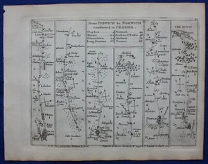
IPSWICH, NORWICH, CROMER, NORFOLK, Pl 81, antique road map, Jefferys, 1775

£33.00
ApproximatelyEUR 39.50
Condition:
“Very good condition. Light age toning. Very minor nick to the top left edge of the sheet, not ”... Read moreAbout condition
Postage:
£9.50 (approx EUR 11.37) Royal Mail International Tracked.
Located in: Ilkley, United Kingdom
Delivery:
Estimated between Mon, 30 Sep and Fri, 4 Oct to 43230
Dispatched today if paid within 33 mins
Returns:
30 days return. Buyer pays for return postage.
Payments:
Shop with confidence
Seller assumes all responsibility for this listing.
eBay item number:333693652496
Item specifics
- Seller notes
- County
- Suffolk, Norfolk
- Cartographer/Publisher
- Thomas Jefferys
- Printing Technique
- Copper Plate
- Date Range
- 1700-1799
- Original/Reproduction
- Antique Original
- Country/Region
- England
- Era
- 1700s
- Format
- Atlas Map
- Type
- Road Atlas Map
- Year
- 1775
Item description from the seller
Business seller information
Maps etc. Antique Maps & Prints
Tristan Wade
1 Brooklands Lane
Menston
Ilkley
West Yorkshire
LS29 6PL
United Kingdom
I certify that all my selling activities will comply with all EU laws and regulations.

Popular categories from this shop
Registered as a business seller
Seller Feedback (2,391)
- i***0 (480)- Feedback left by buyer.Past monthVerified purchaseThank you, map in great condition.
- 1***d (32)- Feedback left by buyer.Past monthVerified purchaseBelle transaction
- t***t (39)- Feedback left by buyer.Past monthVerified purchaseGot to Australia very quickly in excellent condition.
More to explore:
- Norfolk Antique County Maps,
- Thomas Jefferys Antique Maps, Atlases & Globes,
- Antique European Maps & Atlases Norfolk,
- Norfolk Antique Europe Sheet Maps,
- Norfolk Antique Europe Folding Maps,
- Norfolk Antique Europe Ordnance Survey Maps,
- Norfolk Antique Original Antique European Maps & Atlases,
- John Speed Norfolk Antique Europe Maps & Atlases,
- Road Atlas Antique Folding Maps,
- Norfolk 1900-1909 Date Range Antique Europe Sheet Maps