Picture 1 of 7


Gallery
Picture 1 of 7


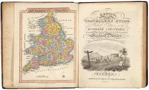
Antique Atlas "Pocket Edition of the English Counties" James Wallis, 1827
£750.00
ApproximatelyEUR 882.06
or Best Offer
Condition:
- Buy it nowAntique Atlas "Pocket Edition of the English Counties" James Wallis, 1827
Oops! Looks like we're having trouble connecting to our server.
Refresh your browser window to try again.
Postage:
£18.00 (approx EUR 21.17) Royal Mail International Tracked.
Located in: London, United Kingdom
Delivery:
Estimated between Tue, 6 May and Mon, 12 May to 43230
Returns:
No returns accepted.
Payments:
Shop with confidence
Seller assumes all responsibility for this listing.
eBay item number:335558071268
Item specifics
- Format
- Atlas
- Era
- 1800s
- Printing Technique
- Copper Plate
- Year
- 1827
- Country/Region
- England, United Kingdom, Wales
- Cartographer/Publisher
- James Wallis - William Lewis
- Antique
- Yes
- Date Range
- 1800-1899
- Type
- World Atlas
- Original/Reproduction
- Antique Original
Item description from the seller
Seller business information
CRN: 07952137

Popular categories from this shop
Seller Feedback (265)
- l***l (611)- Feedback left by buyer.Past monthVerified purchaseall good, as described.
- a***n (55)- Feedback left by buyer.Past monthVerified purchaseAs described. Shipped with great care. Loved he sent prominence along w it
- eBay automated Feedback- Feedback left by buyer.Past monthOrder completed successfully – tracked and on time
More to explore:
- County Map Antique Atlas,
- Antique Original County Map Antique Atlas,
- County Map Antique Atlas Maps,
- County Map Antique Europe Atlas,
- County Durham County Map Antique Europe Atlas Maps,
- John Bartholomew County Map Antique Atlas Maps,
- Lancashire County Map Antique Europe Atlas Maps,
- Leicestershire County Map Antique Europe Atlas Maps,
- Devon County Map Antique Europe Atlas Maps,
- Dorset County Map Antique Europe Atlas Maps
Popular categories from this shop
Seller Feedback (265)
- l***l (611)- Feedback left by buyer.Past monthVerified purchaseall good, as described.
- a***n (55)- Feedback left by buyer.Past monthVerified purchaseAs described. Shipped with great care. Loved he sent prominence along w it
- eBay automated Feedback- Feedback left by buyer.Past monthOrder completed successfully – tracked and on time