Picture 1 of 4


Picture 1 of 4

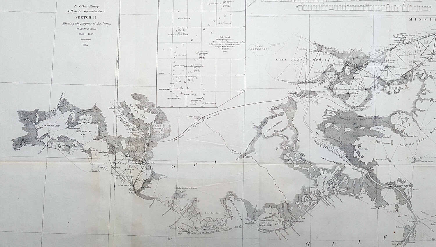


1855 US Coast Survey Large Antique Map Mississippi Delta, Louisiana to Alabama

US $675.00
ApproximatelyEUR 606.36
or Best Offer
Condition:
Postage:
US $14.99 (approx EUR 13.47) Standard Shipping from outside US.
Located in: Ivanhoe, VIC, Australia
Delivery:
Estimated between Tue, 1 Oct and Tue, 15 Oct to 43230
Returns:
30 days return. Seller pays for return postage.
Payments:
Shop with confidence
Seller assumes all responsibility for this listing.
eBay item number:374571793384
Item specifics
- Date Range
- 1800-1899
- Type
- Nautical Map
- US State
- Louisiana, Mississippi
- Format
- Folding Map
- Printing Technique
- Lithography
- Year
- 1855
- Original/Reproduction
- Antique Original
- City
- New Orleans
- Country/Region
- United States of America
Item description from the seller
Business seller information
Classical Images
Simon Mayers
14 Eaglemont Crescent
Eaglemont
3084 Melbourne, Victoria
Australia
Website: www.classicalimages.com
Value added tax number:
- AU 54097057022
I certify that all my selling activities will comply with all EU laws and regulations.

Registered as a business seller
Seller Feedback (6,533)
- 3***a (146)- Feedback left by buyer.Past monthVerified purchaseAwesome item, great delivery, would buy from this seller again no problem
- y***p (88)- Feedback left by buyer.Past monthVerified purchaseAccurate description. Prompt responses to questions. Shipped in great condition.
- y***p (88)- Feedback left by buyer.Past monthVerified purchaseAccurate description. Prompt responses to questions. Shipped in great condition.
More to explore:
- Antique Ordnance Survey Maps,
- Louisiana Antique North America City Maps,
- Mississippi Antique North America Wall Maps,
- Ordnance Survey Map Antique Folding Maps,
- Louisiana Antique North America Wall Maps,
- 1940-1949 Antique Ordnance Survey Maps,
- 1930-1939 Antique Ordnance Survey Maps,
- Vintage Original Antique Ordnance Survey Maps,
- 1950-1959 Antique Ordnance Survey Maps,
- 1910-1919 Antique Ordnance Survey Maps