Picture 1 of 6


Picture 1 of 6


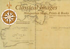
1742 Henry Popple & George Le Rouge Large Antique Map of Colonial America

US $2,525.00
ApproximatelyEUR 2,260.11
or Best Offer
Condition:
“VG”
Postage:
US $44.99 (approx EUR 40.27) Expedited Shipping from outside US.
Located in: Ivanhoe, VIC, Australia
Delivery:
Estimated on or before Fri, 4 Oct to 43230
Returns:
30 days return. Seller pays for return postage.
Payments:
Shop with confidence
Seller assumes all responsibility for this listing.
eBay item number:374673773833
Item specifics
- Seller notes
- “VG”
- Date Range
- 1700-1799
- Type
- World Atlas
- Format
- Atlas Map
- Printing Technique
- Copper Plate
- Year
- 1742
- Original/Reproduction
- Antique Original
- Cartographer/Publisher
- Le Rouge
- Country/Region
- United States of America
Item description from the seller
Business seller information
Classical Images
Simon Mayers
14 Eaglemont Crescent
Eaglemont
3084 Melbourne, Victoria
Australia
Website: www.classicalimages.com
Value added tax number:
- AU 54097057022
I certify that all my selling activities will comply with all EU laws and regulations.

Registered as a business seller
Seller Feedback (6,534)
- 3***a (151)- Feedback left by buyer.Past monthVerified purchaseAwesome item, great delivery, would buy from this seller again no problem
- y***p (88)- Feedback left by buyer.Past monthVerified purchaseAccurate description. Prompt responses to questions. Shipped in great condition.
- y***p (88)- Feedback left by buyer.Past monthVerified purchaseAccurate description. Prompt responses to questions. Shipped in great condition.
More to explore:
- Antique North America Maps & Atlases,
- Antique North America County Maps,
- Antique South America Sheet Maps,
- Antique South America Maps & Atlases,
- Antique North America Folding Maps,
- Antique South America Folding Maps,
- Antique South America Wall Maps,
- Antique North America Geological Maps,
- Antique South America Topographical Maps,
- Geological Map Antique North America Sheet Maps