


4,000+ results for £1 ireland
- BANTRY BAY, Sheet 1, IRELAND WEST COAST, 1856 ADMIRALTY SEA CHART. No.1840Opens in a new window or tabPrivateEUR 33.06andrewg8596 (3,409) 99.5%+ EUR 13.23 postagefrom United Kingdom
- IRELAND HIBERNIA 16th CENTURY 1567 ELIZABETH 1st FINE MOUNTED DECORATIVE MAPOpens in a new window or tabBusinessEUR 15.87historicpicturesarchives (4,272) 99.9%+ EUR 13.16 postagefrom United Kingdom
- Central Bank Of Ireland 1 pound 1990Opens in a new window or tabPrivateEUR 50.16 EUR 50.16 per 10g(EUR 50.16/10g)hellmut7112 (70) 100%+ EUR 2.87 postagefrom New Zealand
- OLD COLOURED MAP - MAJORCA -SPAIN -1760 - GEOGRAPHER T.C. LOTTER - 22 X 17 1/2Opens in a new window or tabBusinessEUR 111.10thefatwilly (16,568) 99.8%Was: EUR 158.71 30% off+ EUR 29.10 postagefrom United Kingdom
- Ireland ordnance survey maps 1 & 2 Tory Island Londonderry Coleraine CarndonaghOpens in a new window or tabBusinessEUR 17.47goldfishantiques1 (3,413) 99.7%+ EUR 2.36 VAT will apply1 bid · Time left1d 11h left (Tue, 02:11 AM)+ EUR 7.94 postagefrom United Kingdom
- Antique Ordnance Survey Map Kenmare Ireland Sheet #184 I Inch To 1 Mile 1903Opens in a new window or tabPrivateEUR 34.92langluggitgadgie (4,869) 100%+ EUR 4.71 VAT will apply0 bids · Time left4d 22h left (Fri, 01:14 PM)+ EUR 11.20 postagefrom United Kingdom
- IRELAND P.64 3X1 POUND 1970/75 VINTAGE CIRCULATED WE COMBINE 2403Opens in a new window or tabBusinessEUR 17.13globalnumisnotes (12,839) 99.4%+ EUR 11.99 postagefrom United States
- Fine Hallmarked Sterling Silver Elliptical Snuff Box By Stokes & Ireland LtdOpens in a new window or tabBusinessEUR 48.94petra40cat (18,416) 99.6%+ EUR 11.26 VAT will apply12 bids · Time left1d 19h left (Tue, 09:50 AM)+ EUR 20.07 postagefrom United Kingdom
- IRELAND DUBLIN Anonymous SILVER Ar PENNY from Phase III 1035-1055 AD 1,05 gr.Opens in a new window or tabPrivateEUR 91.39pana_nis (1,639) 100%+ EUR 12.57 postagefrom Serbia
- IRELAND P.64 3X1 POUND 1975 VINTAGE (B) CIRCULATED WE COMBINE 2403Opens in a new window or tabBusinessEUR 17.13globalnumisnotes (12,839) 99.4%+ EUR 11.99 postagefrom United States
- New listing1st Edition (1863) Geological Map of the Markinch area. Fife & Kinross Sheet 24.Opens in a new window or tabPrivateEUR 79.24Customs services and international tracking providedvikadam2017 (114) 100%+EUR 23.91 postage estimatefrom United Kingdom
- New listing1st Edition (1875) Geological Map of the Kilsyth area. Stirlingshire Sheet 28.Opens in a new window or tabPrivateEUR 87.39Customs services and international tracking providedvikadam2017 (114) 100%+EUR 24.19 postage estimatefrom United Kingdom
- New listing1st Edition (1868) Geological Map of the Lochgelly area. Fife & Kinross Sheet 31Opens in a new window or tabPrivateEUR 81.57Customs services and international tracking providedvikadam2017 (114) 100%+EUR 23.99 postage estimatefrom United Kingdom
- Provincial Bank Of Ireland Limited 1 pound 1977Opens in a new window or tabPrivateEUR 64.50 EUR 64.50 per 100g(EUR 64.50/100g)hellmut7112 (70) 100%+ EUR 2.87 postagefrom New Zealand
- Provincial Bank of ireland 1 pound 1977Opens in a new window or tabPrivateEUR 55.90 EUR 55.90 per 100g(EUR 55.90/100g)hellmut7112 (70) 100%+ EUR 2.87 postagefrom New Zealand
- Battle of Trafalgar plan 1 A K Johnston map Alison's Atlas 1850 art print posterOpens in a new window or tabBusinessEUR 25.00victorianmaps (518) 100%+ EUR 18.65 postagefrom United Kingdom14 watchers
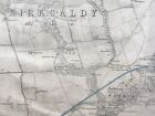
- New listing1st Edition (1856) Topo Map of the Kirkcaldy area. Fife & Kinross Sheet 32Opens in a new window or tabPrivateEUR 52.44Customs services and international tracking providedvikadam2017 (114) 100%+EUR 21.59 postage estimatefrom United Kingdom
- New listing1st Edition (1862) Geological Map of the Kirkcaldy area. Fife & Kinross Sheet 32Opens in a new window or tabPrivateEUR 79.24Customs services and international tracking providedvikadam2017 (114) 100%+EUR 23.91 postage estimatefrom United Kingdom
- New listing1st Edition (1870) Geological Map of the Rutherglen area. Lanarkshire Sheet 10.Opens in a new window or tabPrivateEUR 69.92Customs services and international tracking providedvikadam2017 (114) 100%+EUR 23.58 postage estimatefrom United Kingdom
- New listing1st Edition (1855) Topo Map of the East Fife area. Fife & Kinross Sheet 19Opens in a new window or tabPrivateEUR 87.39Customs services and international tracking providedvikadam2017 (114) 100%+EUR 23.50 postage estimatefrom United Kingdom
- Malanggan 1 Bildwerke von Neuirland New Ireland Papua. Klaus Helfrich 1st Ed.Opens in a new window or tabPre-owned | PrivateEUR 22.65godstick (3,264) 100%+ EUR 48.51 postagefrom Australia
- 1981 - 1 Pound central bank of Ireland Serial Number LIG 963515Opens in a new window or tabPrivateEUR 15.99ravenaag (1,129) 100%+ EUR 26.70 postagefrom United States
- New listing1st Edition (1875) Geological Map of the Stirling area. Stirlingshire Sheet 17.Opens in a new window or tabPrivateEUR 81.57Customs services and international tracking providedvikadam2017 (114) 100%+EUR 23.99 postage estimatefrom United Kingdom
- IRELAND with roads. 1st Irish railway Kingstown-Dublin-Drogheda SDUK 1844 mapOpens in a new window or tabBusinessEUR 107.50richben1066 (24,049) 99.9%+ EUR 15.77 postagefrom United Kingdom
- New listing1st Edition (1878) Geological Map of the Forth area. Lanarkshire Sheet 20.Opens in a new window or tabPrivateEUR 75.74Customs services and international tracking providedvikadam2017 (114) 100%+EUR 23.78 postage estimatefrom United Kingdom
- New listing1st Edition (1878) Geo Map of the Ochill Hills Perth & Clackmannan Sheet 133.Opens in a new window or tabPrivateEUR 75.74Customs services and international tracking providedvikadam2017 (114) 100%+EUR 23.78 postage estimatefrom United Kingdom
- Antique Map Of Greece (1)Opens in a new window or tabPrivateEUR 2.33Customs services and international tracking provided0 bids · Time left4d 1h left (Thu, 04:39 PM)lukes-antiques (355) 100%+EUR 13.77 postage estimatefrom United Kingdom
- IRELAND P.64 3X1 POUND 1975 VINTAGE (A) CIRCULATED WE COMBINE 2403Opens in a new window or tabBusinessEUR 17.13globalnumisnotes (12,839) 99.4%+ EUR 11.99 postagefrom United States
- Book of Kells Facsimile. 678 page full color facsimileOpens in a new window or tabBusinessEUR 464.36biblio87 (597) 94.1%+ EUR 49.48 postagefrom United States14 watchers
- WW1 Daily Chronicle War Map of Europe, linen backed [27724]Opens in a new window or tabBusinessEUR 52.361965philipm13 (12,613) 100%Was: EUR 59.50 12% off+ EUR 6.61 postagefrom United Kingdom
- Ordnance Survey Map 1905 Ireland Sheet 6 Mayo 1 Inch to 4 MilesOpens in a new window or tabBusinessEUR 13.18Customs services and international tracking providedmoreton_collectables (6,837) 100%+EUR 15.20 postage estimatefrom United Kingdom
- Battle of Waterloo plan 1 A K Johnston map Alison's Atlas 1850 art print posterOpens in a new window or tabBusinessEUR 25.00victorianmaps (518) 100%+ EUR 18.65 postagefrom United Kingdom5 watchers
- ▌Circa 1900 Canada Militia Domed Beaver w Crown Button made in Limerick Ireland!Opens in a new window or tabPrivateEUR 13.70thompsontrade94 (3,990) 100%+ EUR 26.68 postagefrom United States
- 1940 BELFAST Town Plan Map - 8" to 1 Mile - Ordnance Survey Northern IrelandOpens in a new window or tabBusinessEUR 5.83Customs services and international tracking provided0 bids · Time left1d 22h left (Tue, 12:45 PM)sycamorebooks (58,220) 100%+EUR 15.00 postage estimatefrom United Kingdom
- New listing1st Edition (1874) Geological Map of the Harthill area. Lanarkshire Sheet 9.Opens in a new window or tabPrivateEUR 46.61Customs services and international tracking providedvikadam2017 (114) 100%+EUR 22.09 postage estimatefrom United Kingdom
- New listing1st Edition (1874) Geological Map of the Bothwell area. Lanarkshire Sheet 11.Opens in a new window or tabPrivateEUR 69.92Customs services and international tracking providedvikadam2017 (114) 100%+EUR 23.58 postage estimatefrom United Kingdom
- New listing1st Edition (1878) Geo Map of the Rumbling Bridge area. Perthshire Sheet 135.Opens in a new window or tabPrivateEUR 60.59Customs services and international tracking providedvikadam2017 (114) 100%+EUR 22.57 postage estimatefrom United Kingdom
- 1844 1-page Atlas Map by Olney "BRITISH ISLES" including Ireland / EireOpens in a new window or tabPrivateEUR 30.57buzzwds (22,178) 99.7%+ EUR 28.52 postagefrom United States
- British Isles Ireland United Kingdom 1830's Brue large detailed map hand colorOpens in a new window or tabBusinessEUR 71.15oldmapsoldbooks (12,012) 100%Was: EUR 79.06 10% off+ EUR 32.76 postagefrom United States
- 1890 United Kingdom Geographical Vintage Map Scotland Ireland Wales ORIG C17-1Opens in a new window or tabBusinessEUR 26.25kamartage (523) 99.5%+ EUR 28.82 postagefrom United States
- Thames Estuary Cruising Chart C.1Opens in a new window or tabBusinessEUR 64.50the_fair_man (1,205) 100%+ EUR 39.61 postagefrom United Kingdom
- Vintage CAPPELEN NORGE 1-2 - Norway Road and tourist Map 1966 Used conditionOpens in a new window or tabPrivateEUR 9.19alxddinscave (92) 98.9%+ EUR 7.87 postagefrom United Kingdom
- New listing1st Edition (1875) Geological Map of the Shotts area. Lanarkshire Sheet 13.Opens in a new window or tabPrivateEUR 52.44Customs services and international tracking providedvikadam2017 (114) 100%+EUR 22.29 postage estimatefrom United Kingdom
- New listing1st Edition (1871) Geological Map of the Coalburn area. Lanarkshire Sheet 37.Opens in a new window or tabPrivateEUR 52.44Customs services and international tracking providedvikadam2017 (114) 100%+EUR 22.29 postage estimatefrom United Kingdom
- New listing1st Edition (1861) Geological Map of the Ormiston area. Haddingtonshire Sheet 14Opens in a new window or tabPrivateEUR 69.92Customs services and international tracking providedvikadam2017 (114) 100%+EUR 23.58 postage estimatefrom United Kingdom
- New listing1st Edition (1875) Geological Map of the Stonehouse area. Lanarkshire Sheet 24.Opens in a new window or tabPrivateEUR 58.26Customs services and international tracking providedvikadam2017 (114) 100%+EUR 22.49 postage estimatefrom United Kingdom
- World War 1. Eastern Front Aug 1914 Krasnik Komarov Gnila Lipa battles 1959 mapOpens in a new window or tabBusinessEUR 24.37richben1066 (24,049) 99.9%+ EUR 15.77 postagefrom United Kingdom3 watchers
- IRELAND P.70b-3522 1 POUND 01.11-79 VF WE COMBINE 2401Opens in a new window or tabBusinessEUR 11.42globalnumisnotes (12,839) 99.4%+ EUR 11.99 postagefrom United States
- New listing1st Edition (1874) Geological Map of the Airdrie area. Lanarkshire Sheet 8.Opens in a new window or tabPrivateEUR 81.57Customs services and international tracking providedvikadam2017 (114) 100%+EUR 23.99 postage estimatefrom United Kingdom
- New listing1st Edition (1874) Geological Map of the Wishaw area. Lanarkshire Sheet 18.Opens in a new window or tabPrivateEUR 81.57Customs services and international tracking providedvikadam2017 (114) 100%+EUR 23.99 postage estimatefrom United Kingdom
- New listing1st Edition (1874) Geological Map of the Motherwell area. Lanarkshire Sheet 12Opens in a new window or tabPrivateEUR 75.74Customs services and international tracking providedvikadam2017 (114) 100%+EUR 23.78 postage estimatefrom United Kingdom
- ww1 Folding Map France Lens 11 Scale 1:100,000 Ordnance Survey Official Use 1915Opens in a new window or tabBusinessEUR 23.31Customs services and international tracking providedfarrarscape (11,054) 99.9%+EUR 16.86 postage estimatefrom United Kingdom
- Map of Ancient Greece Northern Part - disbound sheet from 1857 University AtlasOpens in a new window or tabBusinessEUR 41.008bailgatebooks (4,173) 100%+ EUR 9.26 postagefrom United Kingdom
- 1984 Ordnance Survey Map Suffolk - 1:100 000 YellowedOpens in a new window or tabPrivateEUR 4.65Customs services and international tracking providedsassypot56 (894) 100%+EUR 14.61 postage estimatefrom United Kingdom
- Ordnance Survey 1/2" Cloth Map Sheet 16 Wrexham Shrewsbury c1913Opens in a new window or tabBusinessEUR 9.90helena65 (8,274) 100%+ EUR 1.34 VAT will apply0 bids · Time left1d 13h left (Tue, 04:30 AM)EUR 15.87Buy it now+ EUR 15.87 postagefrom United Kingdom
- First Edition 1" Ordnance Survey Map -CardiffOpens in a new window or tabPrivateEUR 33.06trehafod (2,127) 100%+ EUR 66.12 postagefrom United Kingdom
- New listing1st Edition (1865) Topographical Map of the Drymen area. Stirlingshire Sheet 14.Opens in a new window or tabPrivateEUR 64.09Customs services and international tracking providedvikadam2017 (114) 100%+EUR 22.70 postage estimatefrom United Kingdom
- Vintage Ordnance Survey 1: 575,000 Map of Ireland (1964)Opens in a new window or tabPrivateEUR 3.50Customs services and international tracking providedd1choice (5,342) 100%+EUR 14.32 postage estimatefrom United Kingdom
- Map: 1958 Times Atlas; New Zealand, Mid-Century Times Atlas of the WorldOpens in a new window or tabBusinessEUR 46.298bailgatebooks (4,173) 100%+ EUR 9.26 postagefrom United Kingdom
- Antique Print-DENMARK-JUTLAND-Ortelius-606Opens in a new window or tabBusinessEUR 669.45theprintscollectoruk (1,374) 100%Free international postagefrom Netherlands
- WW1 EASTERN FRONT. Belarus Baltics Poland Battle lines 1914-16 1920 old mapOpens in a new window or tabBusinessEUR 38.70richben1066 (24,049) 99.9%+ EUR 15.77 postagefrom United Kingdom8 watchers
- 1st Edition 1" OS Map - Bury St EdmundsOpens in a new window or tabPrivateEUR 33.06trehafod (2,127) 100%+ EUR 66.12 postagefrom United Kingdom
- IRELAND DUBLIN Anonymous SILVER Ar PENNY from Phase V 1065-1095 AD 1 gr. IIIOIIIOpens in a new window or tabPrivateEUR 91.39pana_nis (1,639) 100%+ EUR 12.57 postagefrom Serbia
- 1955 VINTAGE MAP OF IRELAND / SCALE 1:850,000Opens in a new window or tabBusinessEUR 40.98montrealmaps (7,613) 100%+ EUR 10.54 postagefrom CanadaFree returns
- WW1 Western Front New Map Of Europe 2 Sided Otto Wurth Maps - Circa 1918Opens in a new window or tabBusinessEUR 36.89benns16 (1,623) 99.8%+ EUR 23.97 postagefrom United States
- Antique Silver Plated Tray with Shamrock Decoration 4.5" dia. Made In IrelandOpens in a new window or tabBusinessEUR 9.14curbed716 (799) 100%+ EUR 29.53 postagefrom United States
- 1st Edition (1892) Geological Map of the Maryport area - Sheet 101 NW (Maryport)Opens in a new window or tabPrivateEUR 40.78Customs services and international tracking providedvikadam2017 (114) 100%+EUR 21.90 postage estimatefrom United Kingdom
- New listing1st Edition (1861) Geological Map of the Penicuik area. Edinburghshire Sheet 18.Opens in a new window or tabPrivateEUR 64.09Customs services and international tracking providedvikadam2017 (114) 100%+EUR 23.39 postage estimatefrom United Kingdom
- ww1 Folding Map France Calais 13 Scale 1:100,000 Ordnance Survey 1917Opens in a new window or tabBusinessEUR 23.31Customs services and international tracking providedfarrarscape (11,054) 99.9%+EUR 16.86 postage estimatefrom United Kingdom
- Battle of Mount Sorrel, 13th June 1916. Ypres Salient. WW1. Trenches 1932 mapOpens in a new window or tabBusinessEUR 22.93richben1066 (24,049) 99.9%+ EUR 15.77 postagefrom United Kingdom
- OS MAP SHEET 137 1" to a Mile Brighton, Eastbourne & Lewes c.1900'sOpens in a new window or tabBusinessEUR 22.13Customs services and international tracking providedduncanmaggie (5,385) 100%+EUR 12.65 postage estimatefrom United Kingdom
- New listing1st Edition (1864) Geological Map of the Penicuik area. Edinburghshire Sheet 17.Opens in a new window or tabPrivateEUR 40.78Customs services and international tracking providedvikadam2017 (114) 100%+EUR 21.90 postage estimatefrom United Kingdom
- New listing2 Bartholomews vintage cloth maps 1920s Devon 2 miles: 1 inch Tourists CyclistsOpens in a new window or tabBusinessEUR 21.16braver*grace (5,670) 100%+ EUR 9.92 postagefrom United Kingdom
- Napoleonic France 1st Empire Revolutionary France 1806 Glot Desray six sheet mapOpens in a new window or tabBusinessEUR 165.50oldmapsoldbooks (12,012) 100%Was: EUR 183.89 10% off+ EUR 30.45 postagefrom United States
- 1944 US ARMY MAP SERVICES Europe Road Series FRANCE 1:1,000,000 Corps EngineersOpens in a new window or tabBusinessEUR 35.83red_beard_books (2,899) 99.8%Was: EUR 42.15 15% off+ EUR 21.83 postagefrom United States
- Items Per Page


![WW1 Daily Chronicle War Map of Europe, linen backed [27724]](https://i.ebayimg.com/thumbs/images/g/Vn4AAOSwJ3BklZmN/s-l140.jpg)


