29 results for usa navy
- 1853 MAURY'S WIND and CURRENT CHART. SERIES A. SOUTH PACIFIC No. 10 ~ CHILEOpens in a new window or tabSTRAITS OF MAGELLAN, LAND OF DESOLATION, VALDIVIA HILLPrivateEUR 223.71waltwestwood (3,949) 100%+ EUR 41.39 postagefrom United States
- Nautical Chart South Pacific Ocean Pilot 1962 USA NavyOpens in a new window or tabBusinessEUR 74.37sigedon (3,415) 100%+ EUR 23.37 postagefrom Serbia
- A4 Reprint of USA City Town State Map League Island Us Navy PhiladelphiaOpens in a new window or tabBusinessEUR 7.90decopostcards (40,599) 100%+ EUR 7.90 postagefrom United Kingdom
- 1962 Department of the NAVY H.O. 1400 PILOT CHART OF THE NORTH ATLANTIC OCEANOpens in a new window or tabPrivateEUR 35.05tonydc15 (1,479) 100%+ EUR 48.44 postagefrom United States
- Nautical Chart Indian Ocean Pilot US Navy 1962 MaritimeOpens in a new window or tabBusinessEUR 74.37sigedon (3,415) 100%+ EUR 23.37 postagefrom Serbia
- Birds Eye View 1897 League Island U.S. Navy Yard PA Vintage Style City Map 16x24Opens in a new window or tabBrand new | PrivateEUR 14.82artscape_galleries (33,009) 99.6%+ EUR 30.28 postagefrom United States
- Tamalpais Quadrangle (Topography)Opens in a new window or tabBusinessEUR 154.05neatlinemaps (134) 100%+ EUR 71.81 postagefrom United States
- 1884 Map ~ CENTRAL PHILADELPHIA - LEAGUE ISLAND NAVY YARD ~ (10x13) -#P295Opens in a new window or tabPrivateEUR 22.85maphatter (7,593) 99.5%Was: EUR 24.31 6% off+ EUR 23.78 postagefrom United States
- 1937 Map New York City Brooklyn Bridge Prospect Park Navy Yard Flatbush Plan NYOpens in a new window or tabBusinessEUR 21.24c574778 (15,759) 99.6%Was: EUR 26.55 20% off+ EUR 21.24 postagefrom United States
- Map of 25 Foot Channel from Hampton Roads to Norfolk & the U.S. Navy Yard, 1889Opens in a new window or tabPrivateEUR 31.87colonamaps (216) 100%+ EUR 32.50 postagefrom United States
- 1937 McNally Map Chicago Illinois Navy Pier Michigan Avenue Oak Park IL Rt. 66Opens in a new window or tabBusinessEUR 16.99c574778 (15,759) 99.6%Was: EUR 21.24 20% off+ EUR 21.24 postagefrom United States
- Vintage 1980 FORT BELVOIR / INDIAN HEAD Maryland Military Topo MapOpens in a new window or tabPrivateEUR 12.72checkthisout!! (5,465) 100%+ EUR 8.50 postagefrom United States
- June 1950 US Army Navy Air Force Installations Map 42"x 29"Opens in a new window or tabPrivateEUR 37.18dback88 (927) 100%+ EUR 26.50 postagefrom United States
- Chicago 12" Desktop Light Up World Globe Illuminated Cubs Bears Wrigley FieldOpens in a new window or tabBusinessEUR 29.74jhb051975 (2,001) 99.3%Was: EUR 42.48 30% off+ EUR 85.86 postagefrom United States
- Historic Forts of the Old West 1776-1976 Vtg Map US Army Vanguard of FreedomOpens in a new window or tabPrivateEUR 23.36photobomb18 (1,634) 100%+ EUR 26.19 postagefrom United States
- Antique map 1871 arctic sea discoveries north of smith sound by Polaris us navyOpens in a new window or tabPrivateEUR 26.56geoffcoop (33) 100%+ EUR 32.24 postagefrom United States
- 1855 KEY WEST US COASTAL SURVEY BY BEN FRANKLINS GRANDSON A D BACHEOpens in a new window or tabPrivateEUR 92.67gc313 (1,171) 100%+ EUR 21.31 VAT will apply0 bids · Time left2d 18h left (Sun, 05:41 PM)+ EUR 39.63 postagefrom United States
- 1837 Folding Chart of George’s Shoal & Bank, Surveyed by Charles Wilkes, US NavyOpens in a new window or tabBusinessEUR 327.61crottsy (11,869) 99.8%+ EUR 36.72 postagefrom United States
- Vintage USA 1960s Rand McNally 12" World Portrait Globe Raised dark blue compassOpens in a new window or tabPrivateEUR 53.07dogadopt (421) 98.4%+ EUR 104.94 postagefrom United States
- Original 19th c Engraved Map SOUTH VIEW OF OSWEGO ON LAKE ONTARIO New YorkOpens in a new window or tabPrivateEUR 105.71sturmgeo (3,997) 100%+ EUR 32.48 postagefrom United States
- Antique 1906 Pensacola Florida area Navy Yard Warrington Gonzales 30X51" #21119Opens in a new window or tabBusinessEUR 74.05nc27012 (25,007) 100%+ EUR 29.50 postagefrom United States
- 1902 Antica Stampa Litografia:NAVI CORAZZATE,TEDESCHE,ITALIANE,INGLESI,USA.ETC..Opens in a new window or tabBusinessEUR 10.90giospar48 (5,514) 100%+ EUR 8.50 postagefrom Italy
- Vintage 1960 National Geographic Atlas USA Jumbo Large Navy 72 Pages NICEOpens in a new window or tabPrivateEUR 42.50livetologout (1,077) 100%+ EUR 44.98 postagefrom United States
- Norfolk Harbor, Virginia, Showing Present Channel & Proposed Dredging, 1889Opens in a new window or tabPrivateEUR 42.50colonamaps (216) 100%+ EUR 32.82 postagefrom United States
- late 1800s COLOR Map of the UNITED STATES/Army Posts&Camps/Navy Yards&StationsOpens in a new window or tabPrivateEUR 22.57paulishere (20,579) 99.6%Was: EUR 26.55 15% off+ EUR 21.61 postagefrom United States
- 1944 WWII Map D-Day Normandy Invasion Routes Military History War DDay 6x16 PrinOpens in a new window or tabBusinessEUR 12.12artcanthurtu (15,449) 99.7%+ EUR 1.64 VAT will apply0 bids · Time left2d 20h left (Sun, 06:56 PM)+ EUR 30.81 postagefrom United States
- 1908 NY MAP | BROOKLYN NAVY YARD, WILLIAMSBURG | WALLABOUT CANAL NAVAL HOSPITALOpens in a new window or tabBusinessEUR 146.56deal_changer (387) 97%Was: EUR 159.30 8% off+ EUR 57.85 postagefrom United States
- 1927 map and guild to new york city and new England by royal blue linesOpens in a new window or tabPrivateEUR 58.43a-step-back-n-time (1,457) 99.4%+ EUR 28.98 postagefrom United States
- CIVIL WAR MAP-PLATE 114-ATLAS OFFICIAL RECORD,1893,DEFENSES NASHVILLE, DONELSONOpens in a new window or tabPrivateEUR 84.94booksong (2,792) 96%+ EUR 30.83 postagefrom United States
- Western Mediterranean WWII era U.S. Navy Coastal Survey 1942 huge navigation mapOpens in a new window or tabBusinessEUR 135.45oldmapsoldbooks (12,009) 100%Was: EUR 159.36 15% off+ EUR 34.90 postagefrom United States
- Hydrographic Office U.S NAVY 1942 Mercator Projection Maps WW2 1ST EDITIONOpens in a new window or tabPrivateEUR 21.24mykensho (5,200) 99.8%+ EUR 50.89 postagefrom United States
- 1888 OLD GEOGRAPHICAL MAP:TELEGRAPH,RAILROAD LINES/DEBT NATIONAL,WEALTH, ARMY.Opens in a new window or tabBusinessEUR 14.50giospar48 (5,514) 100%+ EUR 8.50 postagefrom Italy
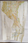
- Antique 1854 Map of the Andes South America U.S. Navy original rareOpens in a new window or tabBusinessEUR 63.73smacshopping (9,341) 99.5%+ EUR 22.79 postagefrom United States
- NAVY DEPARTMENT HYDROGRAPHIC OFFICE / Japan South Coast of Honshu Gulf of TokyoOpens in a new window or tabBusinessEUR 911.29asiabookroom (581) 100%+ EUR 18.23 postagefrom Australia
- Very large 1962 U S Navy Air / Surface chart Davis Strait - Shetland IslesOpens in a new window or tabPrivateEUR 8.77Customs services and international tracking providedisabels-attic52 (232) 100%+EUR 12.92 postage estimatefrom United Kingdom
- New listing1885 McNally Map - World in Hemispheres - Mountains Lakes Areas Army Navy sizesOpens in a new window or tabBusinessEUR 25.49c574778 (15,759) 99.6%Was: EUR 31.86 20% off+ EUR 21.24 postagefrom United States
- Vintage "Map of the 25' Channel from Hampton Roads to Norfolk and U.S. Navy YardOpens in a new window or tabPrivateEUR 15.93valuablethings (6,212) 100%+ EUR 24.38 postagefrom United States
- 1891 U.S. Navy Hydrographic Office Nautical Chart of Port of Veracruz, MexicoOpens in a new window or tabBusinessEUR 463.33geographicusmaps (4,766) 100%+ EUR 42.12 postagefrom United States
- SOUTH ATLANTIC MAURY'S WIND & CURRENT CHART 1854 LARGE ANTIQUE SEA CHARTOpens in a new window or tabBusinessEUR 1,029.63efi6 (1,529) 99.3%+ EUR 28.08 postagefrom France
- Nautical Chart Hawaii North Pacific Ocean Canada USA 1975Opens in a new window or tabBusinessEUR 76.49sigedon (3,415) 100%+ EUR 23.37 postagefrom Serbia
- Antique Sea Chart AFRICA, ANGOLA, BENGUELA,LOBITO, R.CANTONBELLE. Bellin c1750Opens in a new window or tabBusinessEUR 33.18lindisfarne2 (15,642) 100%+ EUR 9.95 postagefrom United Kingdom
- 1948 Map North America East Coast & West Indies HALIFAX TO HISPANIOLA (Navy)Opens in a new window or tabPrivateEUR 43.03hallsnostalgia (19,281) 100%Was: EUR 47.81 10% off+ EUR 29.64 postagefrom United States
- SENEGAL, AFRICA N.Bellin Original antique hand coloured map c1750Opens in a new window or tabBusinessEUR 59.73lindisfarne2 (15,642) 100%+ EUR 9.95 postagefrom United Kingdom
- 1889 Arbuckle Great Britain London Antique Print Trade Card Big Ben Royal NavyOpens in a new window or tabBusinessEUR 19.90mitchmap50 (7,610) 100%+ EUR 6.64 postagefrom United Kingdom
- 1960s US Navy Hydrographic Office 36"x54" North America Halifax to Hispanola MapOpens in a new window or tabBusinessEUR 42.48miss.mdm (14,707) 99.2%+ EUR 51.04 postagefrom United States
- 2009 Portofino New York Harbour Original Painting on 1779 Sea chart C Cohen MapOpens in a new window or tabBusinessEUR 165.90mitchmap50 (7,610) 100%+ EUR 18.58 postagefrom United Kingdom
- 1872 SANFORD & EVERTS-ATLAS OF YORK COUNTY, MAINE MAP-KITTERY U.S. NAVY YARDOpens in a new window or tabPrivateEUR 7.44sajek (12,270) 100%+ EUR 28.07 postagefrom United States
- PAPAU NEW GUINEA 1945 U.S. NAVY EMERGENCY MAP NEW IRELAND TO WUVULU ISLANDOpens in a new window or tabPrivateEUR 43.56garthnw (21,491) 100%+ EUR 30.46 postagefrom United States
- 1954 U.S. Navy Shipboard Zine 'Sultan Sentinel' w/ Guam Pictorial MapOpens in a new window or tabBusinessEUR 875.18geographicusmaps (4,766) 100%+ EUR 42.12 postagefrom United States
- Maine History! Early York / 1872 Hand-Colored Plan of Kittery U.S Navy Yard 1stOpens in a new window or tabPrivateEUR 88.18boyl-timo (1,438) 100%+ EUR 55.36 postagefrom United States
- Day/Night Illuminated Globe, 12 Inches Political Map on outside and ConstellatioOpens in a new window or tabBusinessEUR 98.79juanca003 (289) 97.1%+ EUR 63.56 postagefrom United States
- 1855 US Coast Survey & Bache Antique Map of Galveston Island & Bay, Texas USAOpens in a new window or tabBusinessEUR 307.56searching01 (5,984) 100%+ EUR 15.90 postagefrom AustraliaFree returns
- FLAGS of AMERICA HAWAII SAMOA, NAVY QUARANTINE MEXICO BRAZIL URUQUAY CHILI HAITIOpens in a new window or tabPrivateEUR 11.42mainebeach1 (1,872) 100%Was: EUR 12.70 10% off+ EUR 25.41 postagefrom United States
- USA. USCGS magnetic stations occupied between 1844 and July 1881 1881 old mapOpens in a new window or tabBusinessEUR 33.08richben1066 (24,039) 99.9%+ EUR 15.82 postagefrom United Kingdom
- 1956 WASHINGTON DC U.S. NAVY YARD TO S. CAPITOL & M ST TO P ST ATLAS MAPOpens in a new window or tabBusinessEUR 53.07mschafler (2,734) 97.7%+ EUR 51.94 postagefrom United States
- ORIG. 1956 WASHINGTON DC U.S. NAVY YARD TO S. CAPITOL & M ST TO P ST ATLAS MAPOpens in a new window or tabBusinessEUR 79.63mschafler (2,734) 97.7%+ EUR 52.73 postagefrom United States
- McCLUER GULF TANDJOENG SIBABOE SEMAI 1944 PAPAU NEW GUINEA U.S. NAVY MAP WWIIOpens in a new window or tabPrivateEUR 43.56garthnw (21,491) 100%+ EUR 30.46 postagefrom United States
- NORTHWEST USA 1799 GEORGE VANCOUVER VERY LARGE ANTIQUE ENGRAVED MAPOpens in a new window or tabBusinessEUR 795.62efi6 (1,529) 99.3%+ EUR 28.08 postagefrom France
- 1725 Homann Map of the Caspian Sea and Kamchatka 11x13 Wall Art Print DecorOpens in a new window or tabBusinessEUR 12.12artcanthurtu (15,449) 99.7%+ EUR 1.64 VAT will apply0 bids · Time left2d 20h left (Sun, 06:53 PM)+ EUR 30.81 postagefrom United States
- HUGE ANTIQUE 1943 UNITED STATES AERONAUTICAL WW2 MAP NORTH CAROLINA FLORIDA RAREOpens in a new window or tabBusinessEUR 21.24greypilgrimbooksandmaps (52,621) 99.7%Was: EUR 26.55 20% off+ EUR 26.35 postagefrom United States
- 1899 Judge Political Cartoon Marveling at the Political Status of Admiral DeweyOpens in a new window or tabBusinessEUR 360.37geographicusmaps (4,766) 100%+ EUR 42.12 postagefrom United States
- 1876 Disturnell City Map or Plan of New York City Illustrating School DistrictsOpens in a new window or tabBusinessEUR 463.33geographicusmaps (4,766) 100%+ EUR 42.12 postagefrom United States
- 1757 Map CARTE DE LA FLORIDE DE LA LOUISIANE et PAYS BOISINS USA Bellin (BM3-38)Opens in a new window or tabBusinessEUR 385.89antiquepapercompany (12,972) 99.4%+ EUR 17.54 postagefrom United Kingdom