


7 results for chart dividers
- Old Mural Map Economic Priorities in the three-divided Germany Wall ChartOpens in a new window or tabBusinessEUR 181.41+ EUR 32.40 postagefrom Germanyartfour (1,525) 100%
- Missouri-Columbia divide. USA 1885 old antique vintage map plan chartOpens in a new window or tabBusinessEUR 11.44+ EUR 15.73 postagefrom United Kingdomrichben1066 (24,075) 99.9%
- Africa Divided According to the Extent of Its Principall Parts in Which [...]Opens in a new window or tabBusinessEUR 1,295.88+ EUR 81.83 postagefrom United Statesneatlinemaps (135) 100%
- Projected artificial Lakes on the Panama divide 1885 old antique map chartOpens in a new window or tabBusinessEUR 10.01+ EUR 15.73 postagefrom United Kingdomrichben1066 (24,075) 99.9%
- The Raspadura divide. Colombia 1885 old antique vintage map plan chartOpens in a new window or tabBusinessEUR 17.16+ EUR 15.73 postagefrom United Kingdomrichben1066 (24,075) 99.9%
- HUNTS. Huntingdonshire. Dalton Hogg. (Divided) 1784 old antique map plan chartOpens in a new window or tabBusinessEUR 15.72+ EUR 15.73 postagefrom United Kingdomrichben1066 (24,075) 99.9%
- France divided into circles and departments. BARLOW 1807 old antique map chartOpens in a new window or tabBusinessEUR 38.60+ EUR 15.73 postagefrom United Kingdomrichben1066 (24,075) 99.9%
- Cape Verde Islands African Coast Atlantic Islands c. 1753 Kitchin engraved mapOpens in a new window or tabBusinessEUR 187.44Was: EUR 208.2710% off+ EUR 31.08 postagefrom United Statesoldmapsoldbooks (12,035) 100%
- East Indies Malaysia Indonesia Philippines Sumatra Java Borneo 1806 H Tanner mapOpens in a new window or tabBusinessEUR 127.65Was: EUR 141.8310% off+ EUR 34.32 postagefrom United Statesoldmapsoldbooks (12,035) 100%
- Manchuria Qing Empire China Port Arthur Korea 1899 Johnston detailed mapOpens in a new window or tabBusinessEUR 187.44Was: EUR 208.2710% off+ EUR 31.08 postagefrom United Statesoldmapsoldbooks (12,035) 100%
- Indian Ocean Southern Africa India Southeast Asia Currents 1856 information mapOpens in a new window or tabBusinessEUR 118.19Was: EUR 131.3210% off+ EUR 31.50 postagefrom United Statesoldmapsoldbooks (12,035) 100%
- THE SKY STARS 1742 HOMANN HEIRS & DOPPELMAYR UNUSUAL ANTIQUE CELESTIAL CHARTOpens in a new window or tabANTIQUE COPPER ENGRAVED CELESTIAL CHART OF SKY STARSBusinessEUR 96.077 bids · Time left5d 20h left (Sun, 10:23 PM)+ EUR 23.14 postagefrom Italycesgia (20,219) 100%
- ATLANTIC OCEAN AMERICAS AFRICA EUROPE 1746 BELLIN & VAN SCHLEY ANTIQUE SEA CHARTOpens in a new window or tabANTIQUE COPPER ENGRAVED SEA CHART OF THE ATLANTIC OCEANBusinessEUR 20.363 bids · Time left2d 20h left (Thu, 10:23 PM)+ EUR 23.14 postagefrom Italycesgia (20,219) 100%
- PHILIPPINES EAST INDIES SOUTHEASTERN ASIA 1746 BELLIN & VAN SCHLEY ANTIQUE MAPOpens in a new window or tabANTIQUE ORIGINAL MAP OF EAST INDIES & SOUTHEASTERN ASIABusinessEUR 24.075 bids · Time left2d 20h left (Thu, 10:19 PM)+ EUR 23.14 postagefrom Italycesgia (20,219) 100%
- Chart of the World on Mercator’s Projection.Opens in a new window or tabBusinessEUR 161.98+ EUR 53.01 postagefrom United Statesneatlinemaps (135) 100%
- Welt-Karte der Mission.Opens in a new window or tabBusinessEUR 879.34+ EUR 76.33 postagefrom United Statesneatlinemaps (135) 100%
- A Pictorial Map of Florida by George D. Way 1951 old vintage plan chartOpens in a new window or tabPre-owned | BusinessEUR 348.85+ EUR 40.70 postagefrom United Kingdomrichben1066 (24,075) 99.9%
- Nautical Chart West Indies Ports & Anchorages on North Coast of Cuba No. 410Opens in a new window or tabBusinessEUR 44.87+ EUR 9.24 postagefrom United Kingdom8bailgatebooks (4,174) 100%
- Cyrus' Expedition 10,000 Greeks Xenophon Anatolia Syria 1768 Bowen mapOpens in a new window or tabBusinessEUR 156.01Was: EUR 152.73+ EUR 32.61 postagefrom United Statesoldmapsoldbooks (12,035) 100%
- Gloucester Harbor Massachusetts c. 1910 detailed large hand color coastal chartOpens in a new window or tabBusinessEUR 165.47Was: EUR 161.98+ EUR 33.73 postagefrom United Statesoldmapsoldbooks (12,035) 100%
- Celestial spheres diagrams zones 1719 Chiquet Planetary rotations chart mapOpens in a new window or tabBusinessEUR 118.19Was: EUR 131.3210% off+ EUR 31.50 postagefrom United States13 watchersoldmapsoldbooks (12,035) 100%
- FRANCE. Military Governments. Guthrie 1808 old antique vintage map plan chartOpens in a new window or tabBusinessEUR 11.43+ EUR 15.73 postagefrom United Kingdomrichben1066 (24,075) 99.9%
- County of Peebles. Peebleshire. SAYER / ARMSTRONG 1794 old antique map chartOpens in a new window or tabBusinessEUR 71.51+ EUR 15.73 postagefrom United Kingdomrichben1066 (24,075) 99.9%
- FRANCE. Circles & departments. Guthrie 1801 old antique vintage map plan chartOpens in a new window or tabBusinessEUR 15.72+ EUR 15.73 postagefrom United Kingdomrichben1066 (24,075) 99.9%
- FRANCE. Circles & departments. Guthrie 1801 old antique vintage map plan chartOpens in a new window or tabBusinessEUR 18.58+ EUR 15.73 postagefrom United Kingdomrichben1066 (24,075) 99.9%
- FRANCE. Circles & departments. Guthrie 1801 old antique vintage map plan chartOpens in a new window or tabBusinessEUR 15.72+ EUR 15.73 postagefrom United Kingdomrichben1066 (24,075) 99.9%
- European Continent 1796 Doolittle scarce American engraved mapOpens in a new window or tabBusinessEUR 89.83Was: EUR 99.8110% off+ EUR 30.66 postagefrom United Statesoldmapsoldbooks (12,035) 100%
- FRANCE. Circles & departments. Blomfield 1807 old antique map plan chartOpens in a new window or tabBusinessEUR 15.72+ EUR 15.73 postagefrom United Kingdomrichben1066 (24,075) 99.9%
- FRANCE. Military Governments. Guthrie 1801 old antique vintage map plan chartOpens in a new window or tabBusinessEUR 15.72+ EUR 15.73 postagefrom United Kingdomrichben1066 (24,075) 99.9%
- Palawan Island Culasian Road Philippine Islands 1902 detailed nautical chart mapOpens in a new window or tabBusinessEUR 52.00Was: EUR 57.7810% off+ EUR 32.10 postagefrom United Statesoldmapsoldbooks (12,035) 100%
- Philippine Islands Mindanao Rio Grande harbor 1902 detailed nautical chart mapOpens in a new window or tabBusinessEUR 92.66Was: EUR 102.9610% off+ EUR 33.29 postagefrom United Statesoldmapsoldbooks (12,035) 100%
- Nantucket Massachusetts 1901 Eldridge detailed coastal nautical surveyOpens in a new window or tabBusinessEUR 165.47Was: EUR 161.98+ EUR 33.73 postagefrom United Statesoldmapsoldbooks (12,035) 100%
- Leghorn Livorno Genoa northern Italy Italia Mediterranean coast 1766 Bowen mapOpens in a new window or tabBusinessEUR 127.65Was: EUR 141.8310% off+ EUR 31.77 postagefrom United Statesoldmapsoldbooks (12,035) 100%
- northern England Scotland Wales Ireland 1760 Bellin rare huge sea chart mapOpens in a new window or tabBusinessEUR 329.06Was: EUR 365.6210% off+ EUR 38.01 postagefrom United Statesoldmapsoldbooks (12,035) 100%
- Maps: Street Plans of Liverpool and Manchester from Harmsworth's 1922 AtlasOpens in a new window or tabBusinessEUR 27.72+ EUR 9.24 postagefrom United Kingdom8bailgatebooks (4,174) 100%
- France 1796 Doolittle scarce American engraved mapOpens in a new window or tabBusinessEUR 70.91Was: EUR 78.7910% off+ EUR 30.10 postagefrom United Statesoldmapsoldbooks (12,035) 100%
- Kadavu Fiji Islands Oceania Nautical Chart 1890 Bartholomew scarce mapOpens in a new window or tabBusinessEUR 64.30Was: EUR 71.4410% off+ EUR 29.91 postagefrom United Statesoldmapsoldbooks (12,035) 100%
- 1900 Antique map - Surrey from Bacon's London Atlas - by B.R. DaviesOpens in a new window or tabBusinessEUR 19.78+ EUR 17.29 postagefrom United Kingdomkevin-steele (12,739) 100%
- Map: 1848 Zoological Geography - Division etc.of Gnawing and Ruminating AnimalsOpens in a new window or tabBusinessEUR 56.75+ EUR 9.24 postagefrom United Kingdom8bailgatebooks (4,174) 100%
- FRANCE. Military Governments. Guthrie 1796 old antique vintage map plan chartOpens in a new window or tabBusinessEUR 15.72+ EUR 15.73 postagefrom United Kingdomrichben1066 (24,075) 99.9%
- Greenwich & Apponaug Rhode Island 1901 Eldridge detailed coastal nautical surveyOpens in a new window or tabBusinessEUR 80.37Was: EUR 89.3010% off+ EUR 32.94 postagefrom United Statesoldmapsoldbooks (12,035) 100%
- San Pablo Bay Benicia Vallejo California 1856 U.S. Coastal Survey nautical chartOpens in a new window or tabBusinessEUR 165.47Was: EUR 161.98+ EUR 31.50 postagefrom United Statesoldmapsoldbooks (12,035) 100%
- Nautical Chart No. 98 Plans on the South Coast of Cuba including Puerto CasildaOpens in a new window or tabBusinessEUR 39.59+ EUR 9.24 postagefrom United Kingdom8bailgatebooks (4,174) 100%
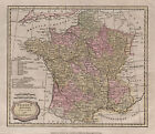
- 1798 John Cary Antique Map of France divided into DepartmentsOpens in a new window or tabBusinessEUR 38.55+ EUR 12.60 postagefrom Australiasearching01 (5,984) 100%
- U.S. Japan Expedition Commodore Perry 1856 Flagships Route Southeast Asia JapanOpens in a new window or tabBusinessEUR 70.91Was: EUR 78.7910% off+ EUR 30.10 postagefrom United Statesoldmapsoldbooks (12,035) 100%
- 1890 Antique map - Buckinghamshire from Bacon's Commercial & Library AtlasOpens in a new window or tabBusinessEUR 13.18+ EUR 17.29 postagefrom United Kingdomkevin-steele (12,739) 100%
- FRANCE. Circles & departments. MORSE 1796 old antique vintage map plan chartOpens in a new window or tabBusinessEUR 18.58+ EUR 15.73 postagefrom United Kingdomrichben1066 (24,075) 99.9%
- 1796 Barrow Large Antique Map Sea Chart Lord Macartneys Voyage England to ChinaOpens in a new window or tabBusinessEUR 609.89+ EUR 46.27 postagefrom AustraliaFree returnssearching01 (5,984) 100%
- ENGLAND WALES. Roads, rail, canals, rivers. Lewis 1831 old antique map chartOpens in a new window or tabBusinessEUR 15.72+ EUR 15.73 postagefrom United Kingdomrichben1066 (24,075) 99.9%
- Isle of Wight rare map 1782 Political mag. Portsmouth England harbor Diving BellOpens in a new window or tabBusinessEUR 291.57Was: EUR 323.9710% off+ EUR 36.79 postagefrom United Statesoldmapsoldbooks (12,035) 100%
- ENGLAND WALES. Roads, rail, canals, rivers. Lewis 1831 old antique map chartOpens in a new window or tabBusinessEUR 15.72+ EUR 15.73 postagefrom United Kingdomrichben1066 (24,075) 99.9%
- Map of Peralta Park, Berkeley, Alameda County, Cal. Subdivided October 1878.Opens in a new window or tabBusinessEUR 2,267.78+ EUR 113.42 postagefrom United Statesneatlinemaps (135) 100%
- Vera Cruz Mexico harbor & city plan 1822 engraved detailed mapOpens in a new window or tabBusinessEUR 80.37Was: EUR 89.3010% off+ EUR 32.94 postagefrom United Statesoldmapsoldbooks (12,035) 100%
- ENGLAND WALES. Roads, rail, canals, rivers. Lewis 1831 old antique map chartOpens in a new window or tabBusinessEUR 15.72+ EUR 15.73 postagefrom United Kingdomrichben1066 (24,075) 99.9%
- Isothermal Chart United States Atlantic Pacific Oceans c. 1856 old antique mapOpens in a new window or tabBusinessEUR 64.30Was: EUR 71.4410% off+ EUR 29.91 postagefrom United Statesoldmapsoldbooks (12,035) 100%
- Vintage Pull Down Map Europe from 1918 to 1945 History Wall Chart MuralOpens in a new window or tabBusinessEUR 199.93+ EUR 32.40 postagefrom Germanyartfour (1,525) 100%
- Antique map, Badeslade & Toms, 1742, England & Wales divided into Counties, ..lOpens in a new window or tabBusinessEUR 79.19+ EUR 19.80 postagefrom United Kingdomboden_antique_maps (909) 97.8%
- Antique map, Badeslade & Toms, 1742, Surrey .Opens in a new window or tabBusinessEUR 79.19+ EUR 19.80 postagefrom United Kingdomboden_antique_maps (909) 97.8%
- Antique map, Badeslade & Toms, 1742, Lincolnshire .Opens in a new window or tabBusinessEUR 79.19+ EUR 19.80 postagefrom United Kingdomboden_antique_maps (909) 97.8%
- Antique map, Badeslade & Toms, 1742, Middlesex .Opens in a new window or tabBusinessEUR 79.19+ EUR 19.80 postagefrom United Kingdomboden_antique_maps (909) 97.8%
- Antique map, Badeslade & Toms, 1742, Derbyshire .Opens in a new window or tabBusinessEUR 79.19+ EUR 19.80 postagefrom United Kingdomboden_antique_maps (909) 97.8%
- Antique map, Badeslade & Toms, 1742, Cheshire .Opens in a new window or tabBusinessEUR 79.19+ EUR 19.80 postagefrom United Kingdomboden_antique_maps (909) 97.8%
- 1896 Antique map - Surrey from Bacon's Commercial & Library AtlasOpens in a new window or tabBusinessEUR 19.78+ EUR 17.29 postagefrom United Kingdomkevin-steele (12,739) 100%
- Southern Night Sky Constellations Zodiac Milky Way 1869 Bar star chart mapOpens in a new window or tabBusinessEUR 64.30Was: EUR 71.4410% off+ EUR 29.91 postagefrom United Statesoldmapsoldbooks (12,035) 100%
- County of Berwick. Berwickshire. SAYER / ARMSTRONG 1794 old antique map chartOpens in a new window or tabBusinessEUR 78.66+ EUR 15.73 postagefrom United Kingdomrichben1066 (24,075) 99.9%
- Antique map, Badeslade & Toms, 1742, Sussex ..Opens in a new window or tabBusinessEUR 79.19+ EUR 19.80 postagefrom United Kingdomboden_antique_maps (909) 97.8%
- 1774 HUGE MAP of Eastern Europe RUSSIA Moscow Scandinavia Tartary ATLASOpens in a new window or tabBusinessEUR 369.32Free international postagefrom United Statesschilb_antiquarian_books (6,817) 100%


