140 results for sheet antique
- VINTAGE ADMIRALTY CHART. No. 657. PANAMA CANAL. 1922 Edition.Opens in a new window or tabPrivateEUR 65.03andrewg8596 (3,408) 99.5%+ EUR 26.54 postagefrom United Kingdom
- VINTAGE ADMIRALTY CHART. No. 2267. GULF of PANAMA. 1915 Edition.Opens in a new window or tabPrivateEUR 65.03andrewg8596 (3,408) 99.5%+ EUR 26.54 postagefrom United Kingdom
- St. VINCENT & THE GRENADINES, WEST INDIES, 1908 ADMIRALTY SEA CHART. No. 791Opens in a new window or tabPrivateEUR 35.08Customs services and international tracking providedandrewg8596 (3,408) 99.5%+EUR 19.93 postage estimatefrom United Kingdom
- 1886 MEXICO MANGROVE BLUFF TO C. CORRIENTES VINTAGE ADMIRALTY CHART MAPOpens in a new window or tabBusinessEUR 91.5814jak (4,253) 100%+ EUR 10.62 postagefrom United Kingdom
- 1891 NEWFOUNDLAND GULF ST. LAWRENCE ATLANTIC MAP ANTIQUE COLOR VICTORIAN ERAOpens in a new window or tabBusinessEUR 28.15machinebuffalo (4,469) 100%+ EUR 32.34 postagefrom United States
- Antique Map "Carta della Jamaica" Anonymous, c. 1770Opens in a new window or tabPrivateEUR 304.04map2map (888) 100%+ EUR 21.05 postagefrom United Kingdom
- Map "Carte Reduite de L'Isle de La Jamaique aux Vaisseaux du Roy" Bellin, 1753Opens in a new window or tabPrivateEUR 496.98map2map (888) 100%+ EUR 21.05 postagefrom United Kingdom
- Antique Map "Isthmus of Panama" John Tallis, 1851Opens in a new window or tabPrivateEUR 92.91map2map (888) 100%+ EUR 23.89 postagefrom United Kingdom
- Antique Map "West Indies" John Thomson, c.1819Opens in a new window or tabPrivateEUR 126.09map2map (888) 100%+ EUR 23.89 postagefrom United Kingdom
- Antique Map "Carta dell'isola di S. Cristoforo" (St Kitts Island) Bellin, 1770Opens in a new window or tabPrivateEUR 119.45map2map (888) 100%+ EUR 23.89 postagefrom United Kingdom
- 1891 QUEBEC DOMINION OF CANADA NOVA SCOTIA MAP ANTIQUE COLOR VICTORIAN ERAOpens in a new window or tabBusinessEUR 13.01machinebuffalo (4,469) 100%Was: EUR 18.59 30% off+ EUR 31.89 postagefrom United States
- 1780 Bonne Map Cuba Havana Bahamas Florida Keys West Indies Caribbean BiminiOpens in a new window or tabBusinessEUR 159.36c574778 (15,759) 99.6%+ EUR 21.24 postagefrom United States
- Antique "Map of the Island of St. Christopher's" (Saint Kitts and Nevis) 1794Opens in a new window or tabPrivateEUR 165.90map2map (888) 100%+ EUR 23.89 postagefrom United Kingdom
- 1906 COLON HARBOUR ISTHMUS OF PANAMA OLD VINTAGE ADMIRALTY CHART MAPOpens in a new window or tabBusinessEUR 174.2414jak (4,253) 100%+ EUR 9.35 postagefrom United Kingdom
- 1882 PORT OF VERA CRUZ TAMPICO HARBOUR APRROACHES VINTAGE ADMIRALTY CHART MAPOpens in a new window or tabBusinessEUR 91.5814jak (4,253) 100%+ EUR 10.62 postagefrom United Kingdom
- 1878-9 MEXICO PORT ANGELES TO MANGROVE BLUFF VINTAGE ADMIRALTY CHART MAPOpens in a new window or tabBusinessEUR 91.5814jak (4,253) 100%+ EUR 10.62 postagefrom United Kingdom
- Antique Map "Piano della Città di S. Domingo" (Dominican Republic)G. Pazzi, 1763Opens in a new window or tabPrivateEUR 257.26map2map (888) 100%+ EUR 21.05 postagefrom United Kingdom
- New listingWest Indies & Central America 1860 Map engraved by Johnston outline colourOpens in a new window or tabBusinessEUR 40.76raremapsandprints (1,511) 100%+ EUR 11.81 postagefrom United Kingdom
- 1891 SWITZERLAND MAP ANTIQUE COLOR VICTORIAN ERAOpens in a new window or tabBusinessEUR 22.63machinebuffalo (4,469) 100%Was: EUR 37.71 40% off+ EUR 32.18 postagefrom United States
- Antique Map "Grenada To Britain" George & Son Philip, 1851.Opens in a new window or tabPrivateEUR 79.63map2map (888) 100%+ EUR 23.89 postagefrom United Kingdom
- 1851 Antique Map; Central America by John Tallis / RapkinOpens in a new window or tabBusinessEUR 66.35kevin-steele (12,712) 100%+ EUR 5.64 postagefrom United Kingdom
- Map "A Plan of the Siege of the Havana drawn by an Officer on the Spot, 1762"Opens in a new window or tabPrivateEUR 204.64map2map (888) 100%+ EUR 21.05 postagefrom United Kingdom
- Antique Map "Jamaica" John Tallis, 1851Opens in a new window or tabPrivateEUR 106.18map2map (888) 100%+ EUR 23.89 postagefrom United Kingdom
- 1891 ASIA CHINA INDIA PERSIA ARABIA SIBERIA SIAM ANTIQUE MAP COLOR VICTORIAN ERAOpens in a new window or tabBusinessEUR 22.63machinebuffalo (4,469) 100%Was: EUR 37.71 40% off+ EUR 32.18 postagefrom United States
- 1891 ASIA CHINA INDIA PERSIA ARABIA SIBERIA SIAM ANTIQUE MAP COLOR VICTORIAN ERAOpens in a new window or tabBusinessEUR 22.63machinebuffalo (4,469) 100%Was: EUR 37.71 40% off+ EUR 32.18 postagefrom United States
- 1956 West Indies South Coast of Cuba Gulf of Batabano MapOpens in a new window or tabPrivateEUR 159.36jamesketcham530 (914) 100%+ EUR 24.20 postagefrom United States
- 1891 JAPAN SEA PACIFIC OCEAN KURILE ISLANDS MAP ANTIQUE COLOR VICTORIAN ERAOpens in a new window or tabBusinessEUR 22.63machinebuffalo (4,469) 100%Was: EUR 37.71 40% off+ EUR 32.18 postagefrom United States
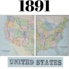
- 1891 US MAPS UNITED STATES EASTERN & WESTERN TWO (2) ANTIQUE COLOR VICTORIAN ERAOpens in a new window or tabBusinessEUR 27.73machinebuffalo (4,469) 100%Was: EUR 46.21 40% off+ EUR 32.33 postagefrom United States
- c1840s West Indies Hand Coloured Antique Map Print Illustration Omnigraph BeckerOpens in a new window or tabBusinessEUR 53.02maparchives (6,288) 98.9%+ EUR 2.26 postagefrom United Kingdom
- 1879 Map Mexico West Indies Central America Victorian Geography 1st Ed DWAA9Opens in a new window or tabPrivateEUR 29.75savagesalesofmaine (1,631) 99.9%Was: EUR 84.98 65% off+ EUR 28.14 postagefrom United States
- 1829-32 WEST INDIA ISLANDS SAN SALVADOR TO SANTO DOMINGO ADMIRALTY CHART MAPOpens in a new window or tabBusinessEUR 118.1214jak (4,253) 100%+ EUR 10.62 postagefrom United Kingdom
- BERMUDA ISLANDS, GRASSY BAY, IRELAND ISLAND, 1888 ADMIRALTY SEA CHART. No.1074Opens in a new window or tabPrivateEUR 29.23Customs services and international tracking providedandrewg8596 (3,408) 99.5%+EUR 19.72 postage estimatefrom United Kingdom
- Antique US Hydrographic Maps - Barbados & Antigua - 40 x 33Opens in a new window or tabPrivateEUR 36.11undertheairplane (1,143) 99.8%+ EUR 31.60 postagefrom United States
- 1891 TURKEY BLACK SEA MEDITERRANEAN ASIA MINOR MAP ANTIQUE COLOR VICTORIAN ERAOpens in a new window or tabBusinessEUR 22.63machinebuffalo (4,469) 100%Was: EUR 37.71 40% off+ EUR 32.18 postagefrom United States
- Antique Map "Carta Esatta Rappresentante L'Isola di Granata" M. Coltellini, 1763Opens in a new window or tabPrivateEUR 99.54map2map (888) 100%+ EUR 23.89 postagefrom United Kingdom
- Antique Map "Carta Esatta Rappresentante l'Isola della Guadalupa" G. Pazzi, 1777Opens in a new window or tabPrivateEUR 233.87map2map (888) 100%+ EUR 21.05 postagefrom United Kingdom
- Nautical Chart No. 3865 West Indies - Cuba, Eastern SheetOpens in a new window or tabBusinessEUR 45.138bailgatebooks (4,173) 100%+ EUR 9.29 postagefrom United Kingdom
- VINTAGE ADMIRALTY CHART. No.867. The NARROWS, GRASSY BANK, BERMUDA. 1949 Edn.Opens in a new window or tabPrivateEUR 57.30Customs services and international tracking providedandrewg8596 (3,408) 99.5%+EUR 13.90 postage estimatefrom United Kingdom
- BERMUDA ISLANDS, WESTERN PART, 1925 ADMIRALTY SEA CHART. No.334Opens in a new window or tabPrivateEUR 29.23Customs services and international tracking providedandrewg8596 (3,408) 99.5%+EUR 19.72 postage estimatefrom United Kingdom
- TRINIDAD, GULF OF PARIA, WEST INDIES, 1957 ADMIRALTY SEA CHART. No.493Opens in a new window or tabPrivateEUR 29.23Customs services and international tracking providedandrewg8596 (3,408) 99.5%+EUR 19.36 postage estimatefrom United Kingdom
- Nautical Chart "Plans in Aruba, Bonaire and Curaçao Islands" U.K. Admiralty 1947Opens in a new window or tabPrivateEUR 79.63map2map (888) 100%+ EUR 23.89 postagefrom United Kingdom
- 1891 SPAIN PORTUGAL MEDITERRANEAN SEA BALEARIAC ANTIQUE MAP COLOR VICTORIAN ERAOpens in a new window or tabBusinessEUR 37.71machinebuffalo (4,469) 100%+ EUR 32.63 postagefrom United States
- 1891 NEW ZEALAND NORTH & SOUTH ISLANDS PACIFIC MAP ANTIQUE COLOR VICTORIAN ERAOpens in a new window or tabBusinessEUR 22.63machinebuffalo (4,469) 100%Was: EUR 37.71 40% off+ EUR 32.18 postagefrom United States
- 1891 RUSSIA MAP UKRAINE BLACK SEA CRIMEA ARCTIC OCEA ANTIQUE COLOR VICTORIAN ERAOpens in a new window or tabBusinessEUR 22.63machinebuffalo (4,469) 100%Was: EUR 37.71 40% off+ EUR 32.18 postagefrom United States
- Map "Carte des Iles-Antilles ou Indes Occidentales" (Caribbean) Brué, 1827Opens in a new window or tabPrivateEUR 175.41map2map (888) 100%+ EUR 21.05 postagefrom United Kingdom
- VINCENZO CORONELLI Archipelague du Mexique Cuba Mexico Florida MAP 1st Ed 1688Opens in a new window or tabBusinessEUR 1,399.35antiquarianbooksandantiquesllc (3,852) 100%+ EUR 70.71 postagefrom United States
- 1891 NETHERLANDS HOLLAND BELGIUM NORTH SEA MAP ANTIQUE COLOR VICTORIAN ERAOpens in a new window or tabBusinessEUR 22.63machinebuffalo (4,469) 100%Was: EUR 37.71 40% off+ EUR 32.18 postagefrom United States
- Map "Mappa Geographica, complectens I. Indiae Occidentalis" Homann Heirs, 1740Opens in a new window or tabPrivateEUR 877.03map2map (888) 100%+ EUR 21.05 postagefrom United Kingdom
- Antique map, Bellin, Carte De L'Isle de la JamaiqueOpens in a new window or tabBusinessEUR 210.49boden_antique_maps (908) 97.7%+ EUR 17.54 postagefrom United Kingdom
- VINTAGE ADMIRALTY CHART. No. 451. Plans in NORTH WEST JAMAICA. 1933 Edition.Opens in a new window or tabPrivateEUR 40.93Customs services and international tracking providedandrewg8596 (3,408) 99.5%+EUR 20.12 postage estimatefrom United Kingdom
- 1851 Antique Map; Isthmus of Panama by John Tallis / RapkinOpens in a new window or tabBusinessEUR 79.62kevin-steele (12,712) 100%+ EUR 5.64 postagefrom United Kingdom13 watchers
- 1891 MANITOBA CANADA NORTHWEST TERRITORIES MAP ANTIQUE COLOR VICTORIAN ERAOpens in a new window or tabBusinessEUR 13.01machinebuffalo (4,469) 100%Was: EUR 18.59 30% off+ EUR 31.89 postagefrom United States
- 1852 Isthmus Darien Map Canal Ship Navigation Plan New Granada Panama ORIGINJALOpens in a new window or tabPrivateEUR 41.31selsa84 (5,106) 100%+ EUR 20.88 postagefrom United States
- SOUTH AMERICA SOUTH SHEET. Shows Bolivia claim on Gran Chaco. JOHNSTON 1913 mapOpens in a new window or tabBusinessEUR 11.51richben1066 (24,039) 99.9%+ EUR 15.82 postagefrom United Kingdom
- 1799 Rare Map Gulf of Mexico, Florida, West Indies, Pierre BertholonOpens in a new window or tabPrivateEUR 146.61sbcanl (473) 100%+ EUR 22.79 postagefrom United States
- VINTAGE ADMIRALTY CHART. No.587. BURICA POINT to MANGROVE BLUFF. 1914 EdnOpens in a new window or tabPrivateEUR 57.30Customs services and international tracking providedandrewg8596 (3,408) 99.5%+EUR 13.90 postage estimatefrom United Kingdom
- 1891 NORTH AMERICA US CANADA MEXICO ALASKA MAP ANTIQUE COLOR VICTORIAN ERAOpens in a new window or tabBusinessEUR 13.01machinebuffalo (4,469) 100%Was: EUR 18.59 30% off+ EUR 31.89 postagefrom United States
- VINTAGE ADMIRALTY CHART. No.697. DOMINICA. 1914 Edition.Opens in a new window or tabPrivateEUR 52.62Customs services and international tracking providedandrewg8596 (3,408) 99.5%+EUR 20.52 postage estimatefrom United Kingdom
- 1891 BRAZIL PERU VENEZUELA SOUTH AMERICA OCEANS MAP ANTIQUE COLOR VICTORIAN ERAOpens in a new window or tabBusinessEUR 37.71machinebuffalo (4,469) 100%+ EUR 32.63 postagefrom United States
- Original Antique Map of West Indies (c1920) inc Central America - StanfordOpens in a new window or tabBusinessEUR 19.90blofieldbooks (19,558) 100%+ EUR 17.24 postagefrom United Kingdom
- 1891 NORTH POLE POLAR REGIONS RUSSIA CANADA MAP ANTIQUE COLOR VICTORIAN ERAOpens in a new window or tabBusinessEUR 55.78machinebuffalo (4,469) 100%Was: EUR 92.96 40% off+ EUR 33.16 postagefrom United States
- c1890 George Philip West Indies Central America Antique Map Print Coloured PlateOpens in a new window or tabBusinessEUR 26.48maparchives (6,288) 98.9%+ EUR 9.69 postagefrom United Kingdom
- Mango Tango Map Virgin Islands 16 X 20 Antiqued Appearance Quality Paper RolledOpens in a new window or tabBusinessEUR 38.19jxd0147 (1,740) 100%Was: EUR 42.44 10% off+ EUR 31.85 postagefrom United States
- Nautical Chart "West Indies S.to Domingo to Dominica" British Admiralty, 1948Opens in a new window or tabPrivateEUR 239.72map2map (888) 100%+ EUR 21.05 postagefrom United Kingdom
- 'General Map of the West Indies'. West sheet only. Bryan EDWARDS. Caribbean 1794Opens in a new window or tabBusinessEUR 1,140.14richben1066 (24,039) 99.9%+ EUR 40.93 postagefrom United Kingdom
- 1891 WORLD MAP GLOBE WESTERN EASTERN HEMISPHERES MAP ANTIQUE COLOR VICTORIAN ERAOpens in a new window or tabBusinessEUR 33.47machinebuffalo (4,469) 100%Was: EUR 55.78 40% off+ EUR 32.50 postagefrom United States
- Vintage Fiji Islands Street MapOpens in a new window or tabPrivateEUR 5.61modjaso (1,055) 100%+ EUR 0.76 VAT will apply0 bids · Time left2d 2h left (Sat, 03:42 PM)EUR 8.49Buy it now+ EUR 43.94 postagefrom United States
- ANTIQUE ADMIRALTY CHART. No.657, PANAMA CANAL and APPROACHES, 1915 Edition.Opens in a new window or tabFirst Published July 21, 1914,25 Days Prior Canal OpensPrivateEUR 146.17Customs services and international tracking providedandrewg8596 (3,408) 99.5%+EUR 16.97 postage estimatefrom United Kingdom
- 1780 Bonne Map West Indies Antilles Virgin Islands Antiqua Barbados Grenada etcOpens in a new window or tabBusinessEUR 105.18c574778 (15,759) 99.6%+ EUR 21.24 postagefrom United States
- Island Of Antigua Admiralty Map, Charts & Publications - 2064 Published 1990Opens in a new window or tabBusinessEUR 1.16itmightbeusefuloneday (3,193) 100%+ EUR 0.16 VAT will apply0 bids · Time left2d 22h left (Sun, 11:11 AM)+ EUR 26.54 postagefrom United Kingdom
- VINTAGE ADMIRALTY CHART. No. 697. DOMINICA. WEST INDIES. 1914. Edition.Opens in a new window or tabPrivateEUR 68.99Customs services and international tracking providedandrewg8596 (3,408) 99.5%+EUR 14.31 postage estimatefrom United Kingdom
- 1940 - 10 by 14 inches Rand McNally Map of the WEST INDIES Excellent condition.Opens in a new window or tabPrivateEUR 8.34pjxk (4,909) 100%+ EUR 27.03 postagefrom United States
- Chart "Jamaica and the Pedro Bank with parts of Cuba and Haiti" Coghlan, 1947Opens in a new window or tabPrivateEUR 132.72map2map (888) 100%+ EUR 23.89 postagefrom United Kingdom
- Shell Oil - 1963 - Foldable Highway Road Map of Mexico and Central AmericaOpens in a new window or tabPre-owned | BusinessEUR 6.64collectibles.chest (1,674) 99.4%+ EUR 9.95 postagefrom United Kingdom
- 1780 Bonne Map Jamaica Montego Bay Port Royal Kingston West Indies Caribbean SeaOpens in a new window or tabBusinessEUR 90.30c574778 (15,759) 99.6%+ EUR 21.24 postagefrom United States
- Items Per Page